ORIGINS 4.2 – THE LATEST FUNCTIONS
- Freddie
- April 2, 2024
- 11:00

Discover all new Origins functions in the latest release of Origins version 4.2!
Due to our constant development and the inspiring feedback from our users, PointCab Origins 4.2 brings
many new functionalities and enhancements.
Check out the new functions below:
NEW FUNCTIONS
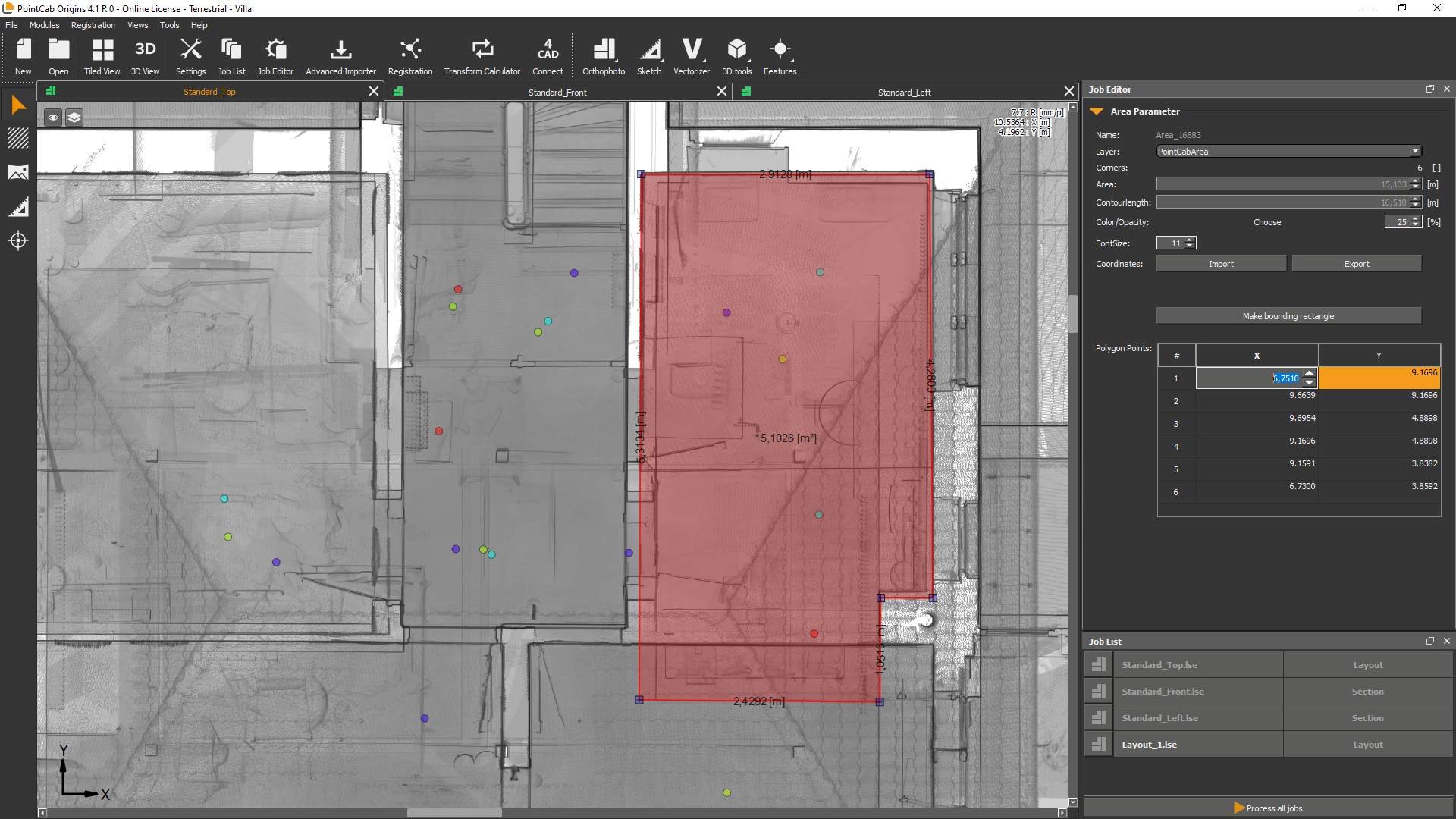
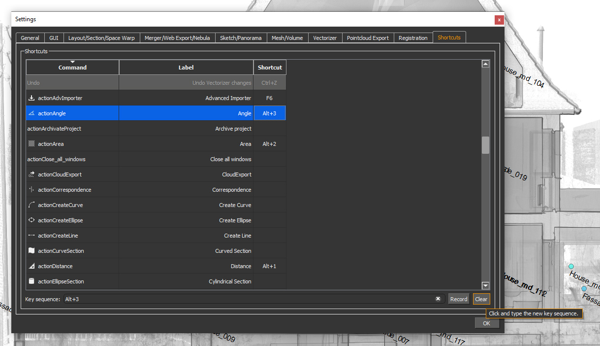
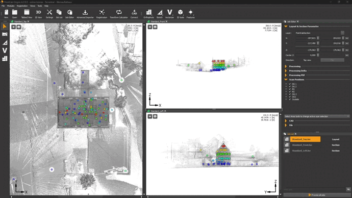
GUI Update: Customize Origins like never before
What it’s for?
Experience Origins with a completely new look and feel: customize and arrange windows in size and position to your liking.
How it’s done:
Just click and drag your windows in Origins and arrange them to your liking.
New License Manager
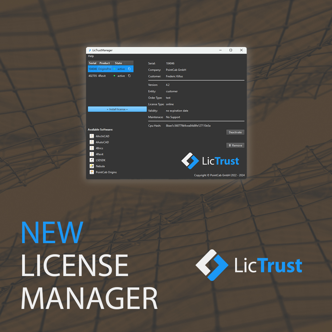
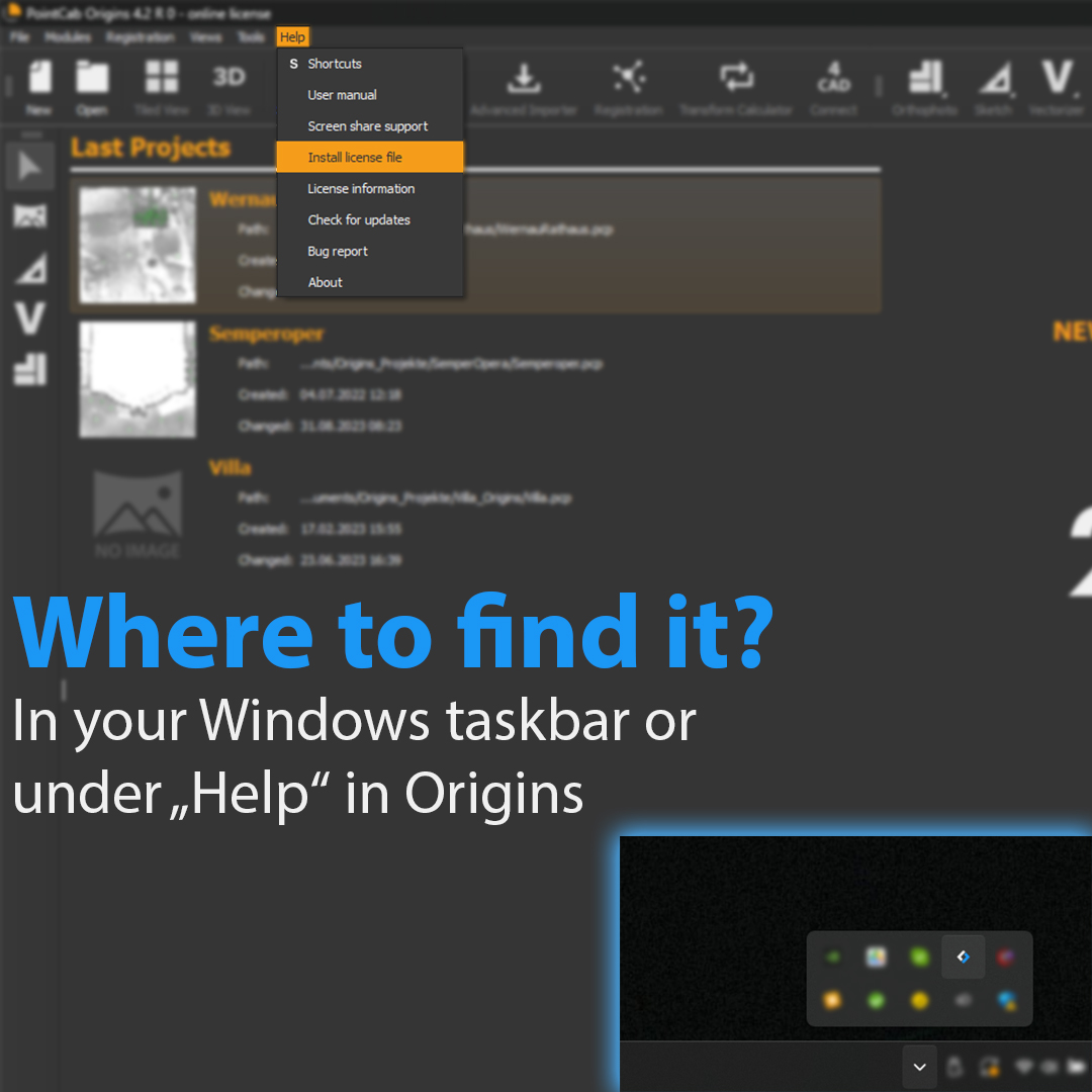
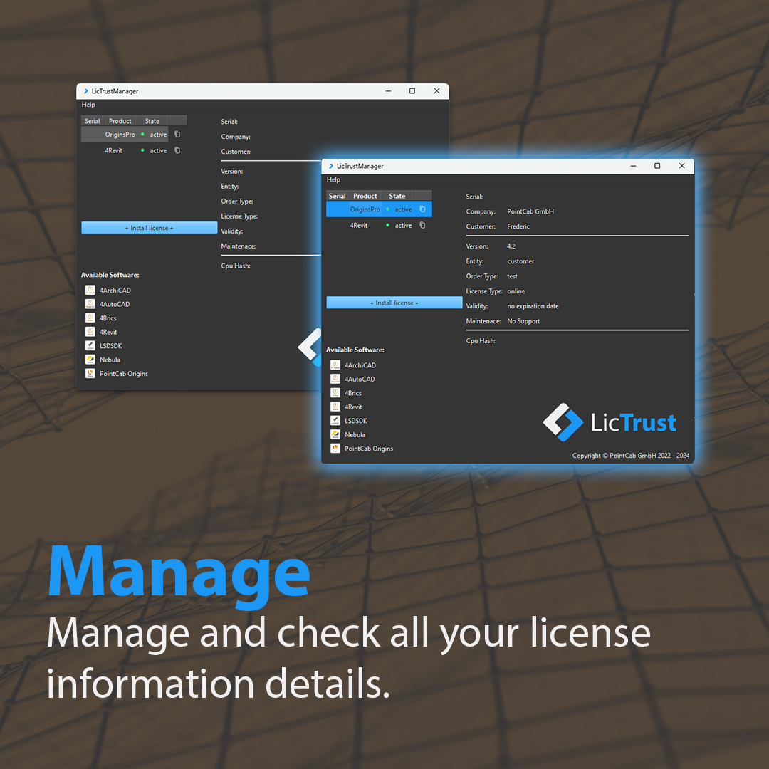
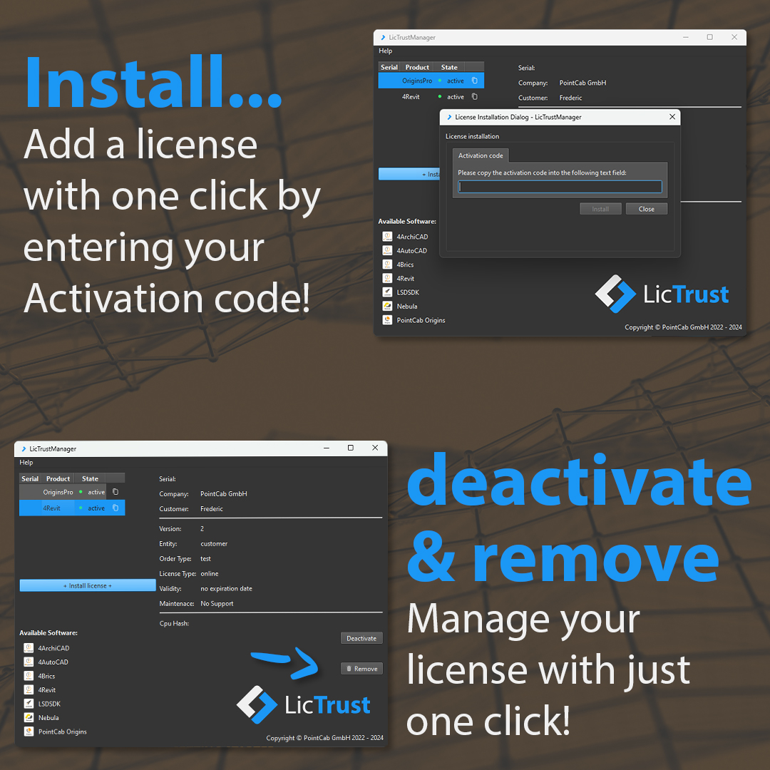
Click to enlarge the picture
What it’s for?
Discover a new, convenient and easy-to-use way to manage all your PointCab Licenses in one place.
How it’s done:
The new License Manager provides an easy way to manage all your PointCab Licenses. Just take a look at our slides and see how it’s done.
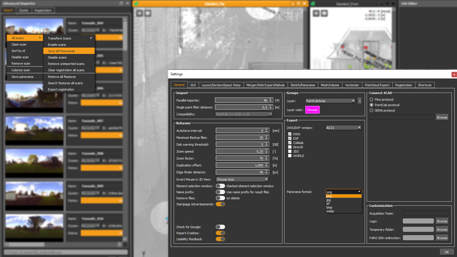
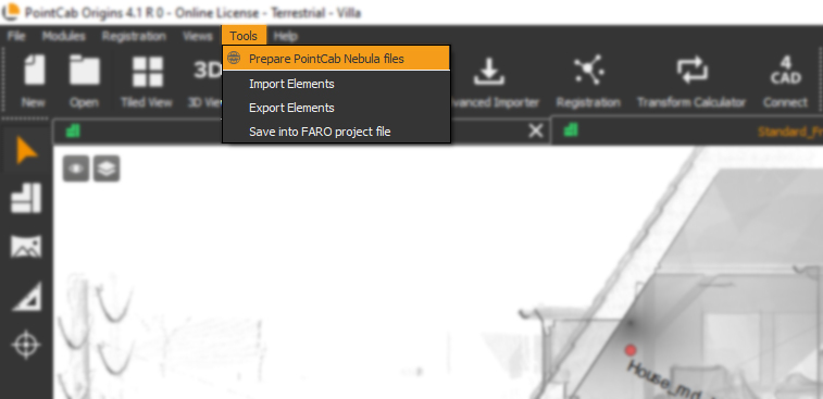
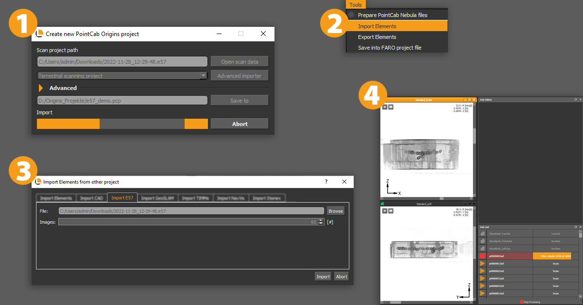
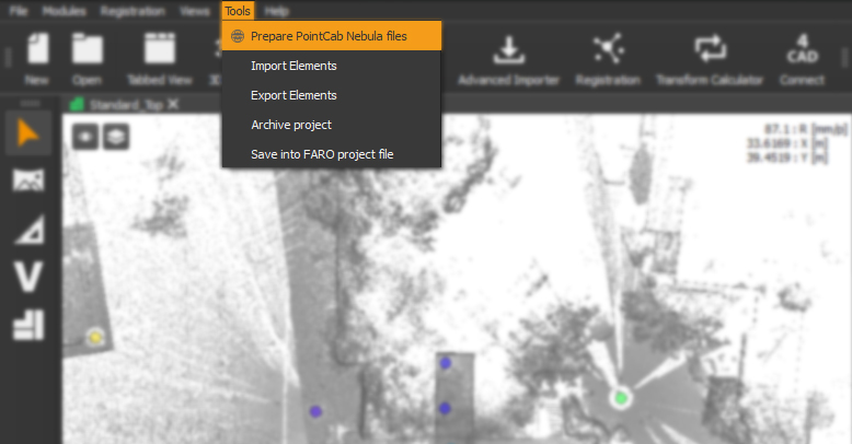
New Tools Menu available
What it’s for?
We have moved!
You’ll now find all options to import Elements and prepare Nebula files in one place in this toolbar.
How it’s done:
Just toggle to the Tools Menu item and find all your options for importing Elements & preparation of Nebula files.
New Vectorizer Tool for rectangles (customer request)💡
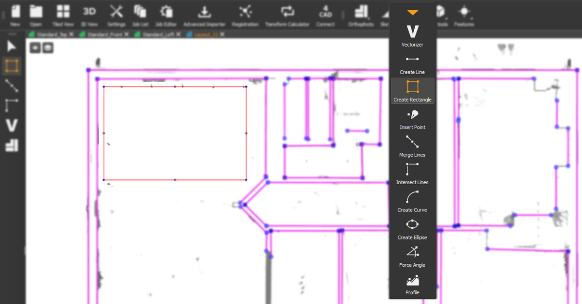
What it’s for?
Enjoy a faster workflow and create rectangle vector lines with one click!
How it’s done:
The new rectangle tool of our Vectorizer creates a rectangle of vector lines with one click. Enabling you to speed up your vectorization!
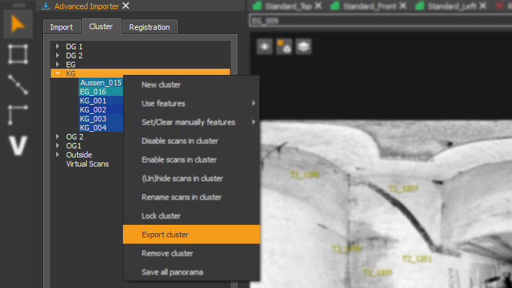
New way to export clusters (customer request)💡
What it’s for?
You can now choose clusters and easily export them as separate projects.
How it’s done:
Just select the clusters you want to export as a separate project and do a right-click. Choose export and that’s it!
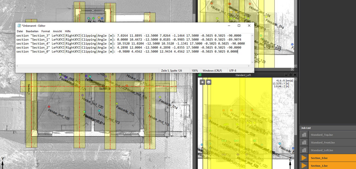
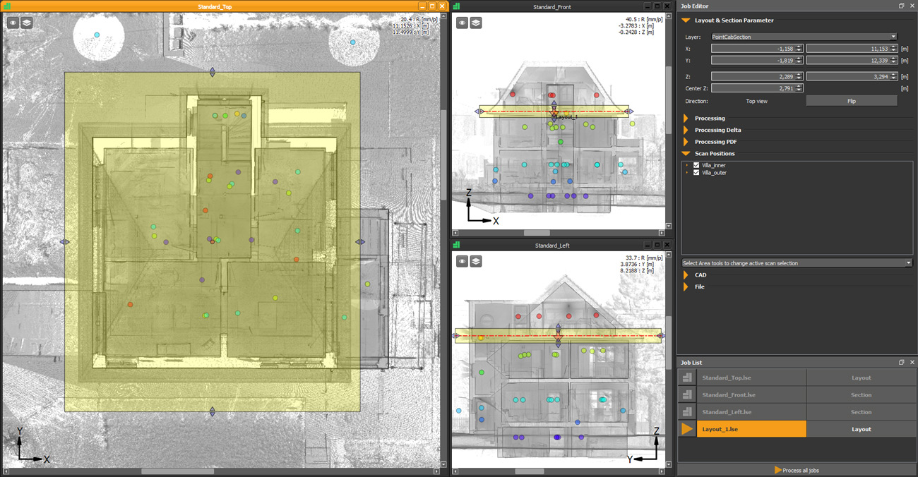
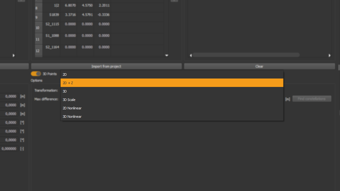
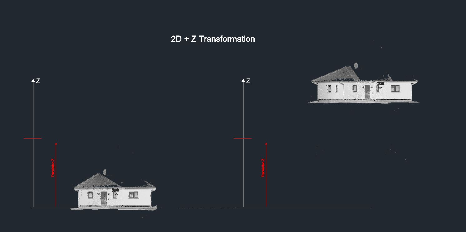
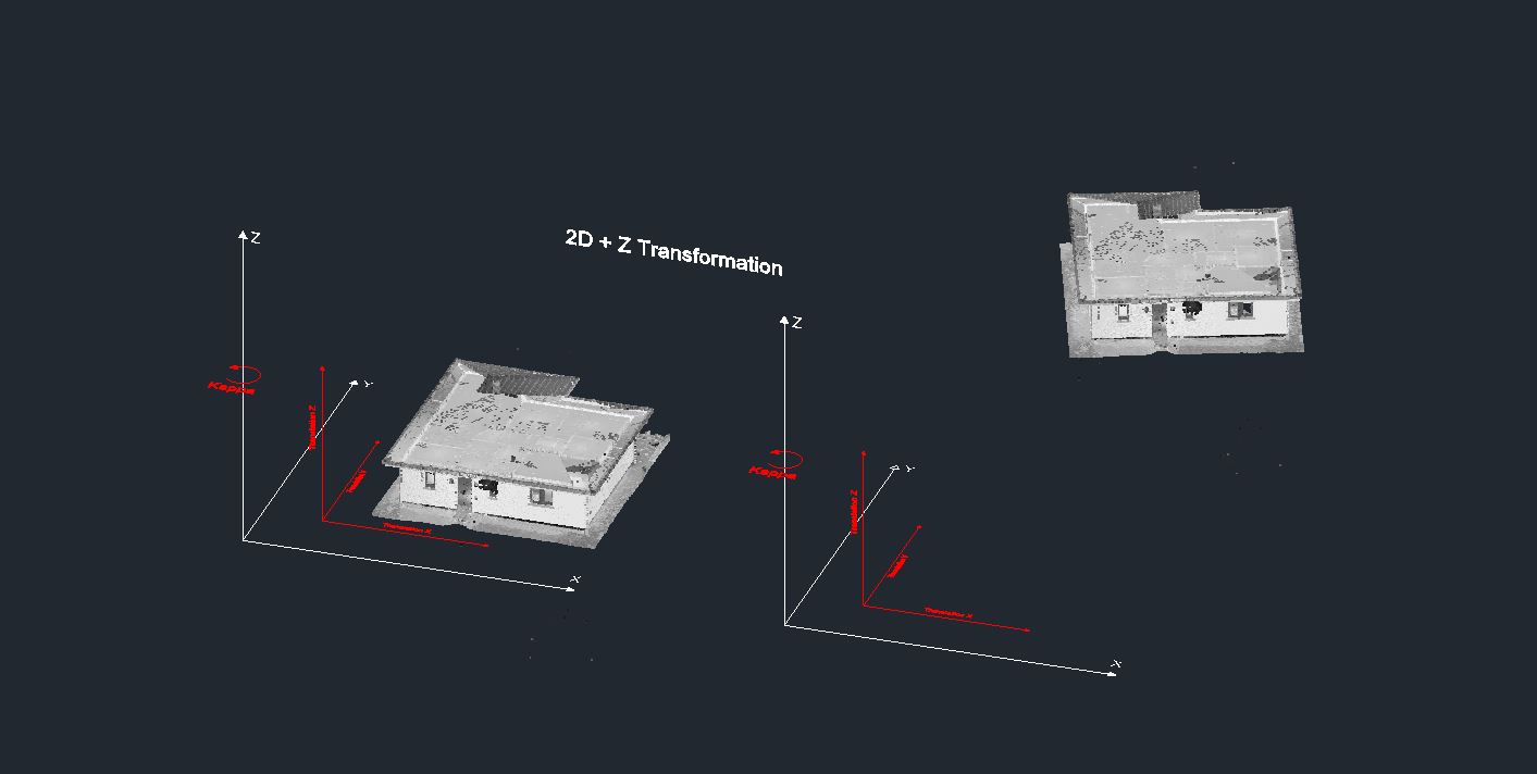
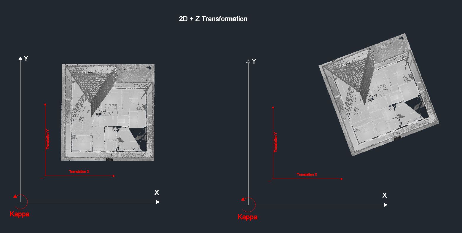
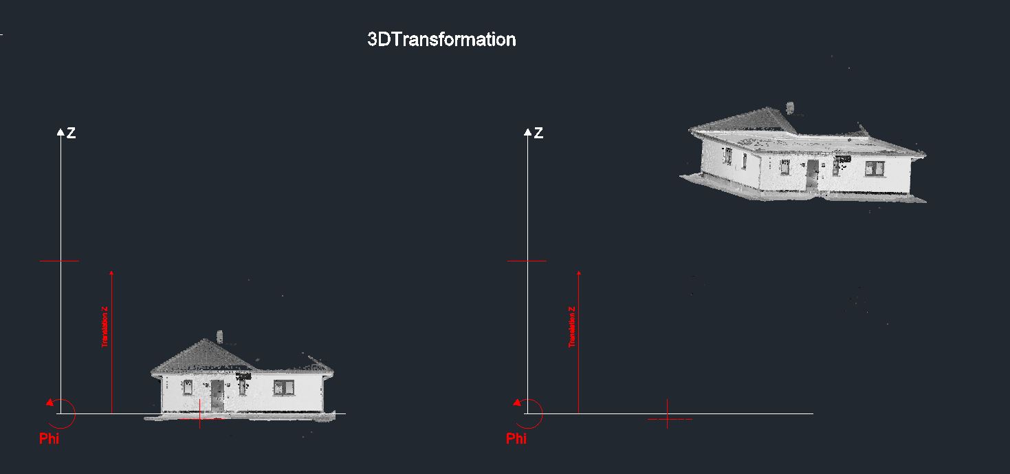
New "2D + Z" transformation method (customer request)💡
What it’s for?
Minimize the risk of errors when selecting identical 3D points!
The new 2D+Z transformation method was developed for projects that require rotation around the Z axis and translation in all three dimensions (XYZ). It ensures an accurate transformation while maintaining the perpendicularity of the object. Verticality is maintained through the registration process and derived from the tilt measurement data.
(Note: The screenshots for the 3D transformation are exaggerated to show that the object can be rotated around all axes.)
How it’s done:
When transforming your point clouds in the Transform Calculator, just select “2D + Z” in the dropdown menu and hit “Find constellations”.

Click to enlarge the picture
GENERAL IMPROVEMENTS
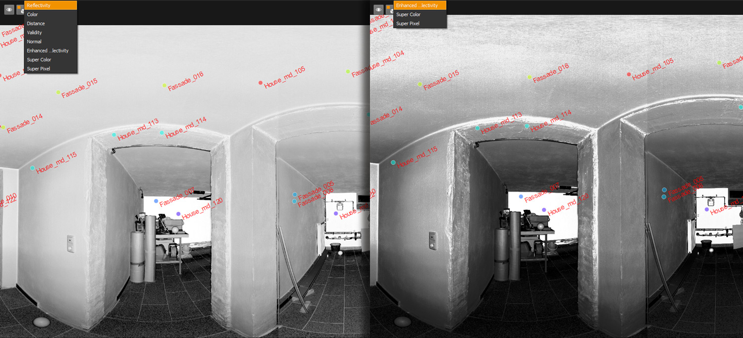
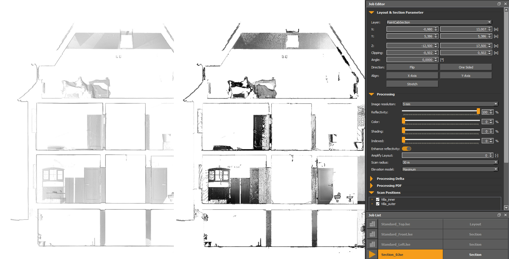
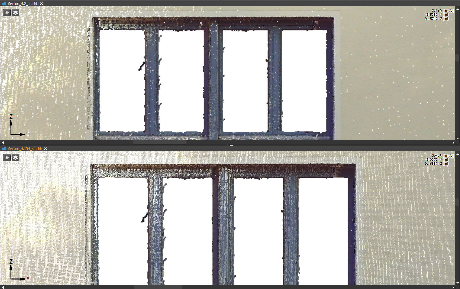
Improved Orthophoto appearance in color sheet (customer request)💡
What it’s for?
We improved the appearance of the color sheets, for a more crisp look and easier workflow. The upper picture demonstrates the better appearance in detail.
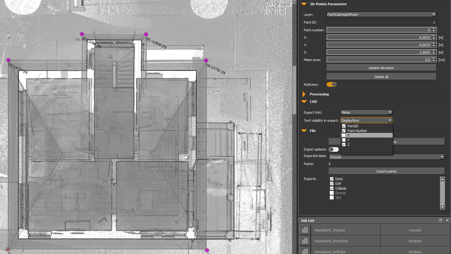
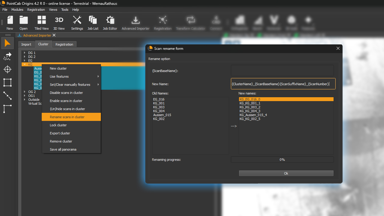
Advanced scan renaming (customer request)💡
What it’s for?
Changing the names of your scans (and cluster) is now a breeze. Just choose the scans you want to rename and give them a new name. Don’t lose track of your projects anymore.
How it’s done:
Just select your cluster and start to rename it to your liking. Everything in brackets is editable.
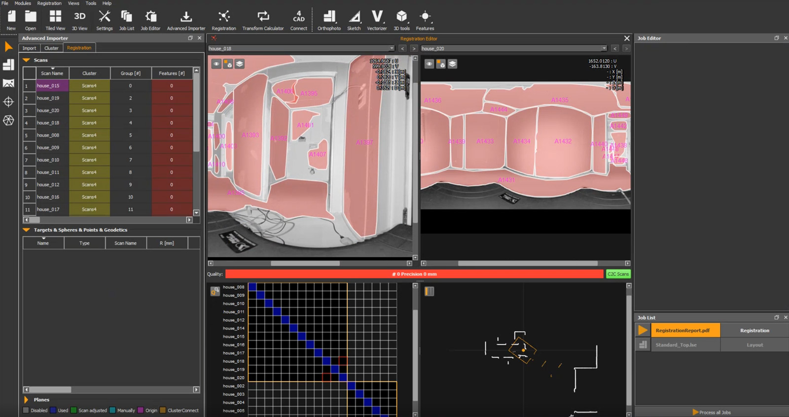
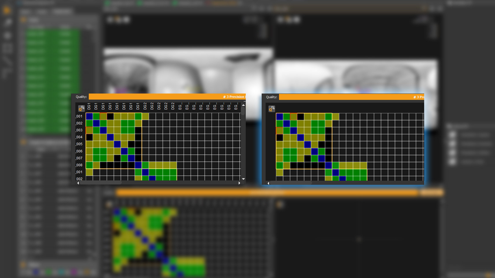
Hide scan names in quality matrix
What it’s for?
Turn on / off the scan names in the quality matrix.
How it’s done?
Simply press “n” on your keyboard to hide or show the scan names.
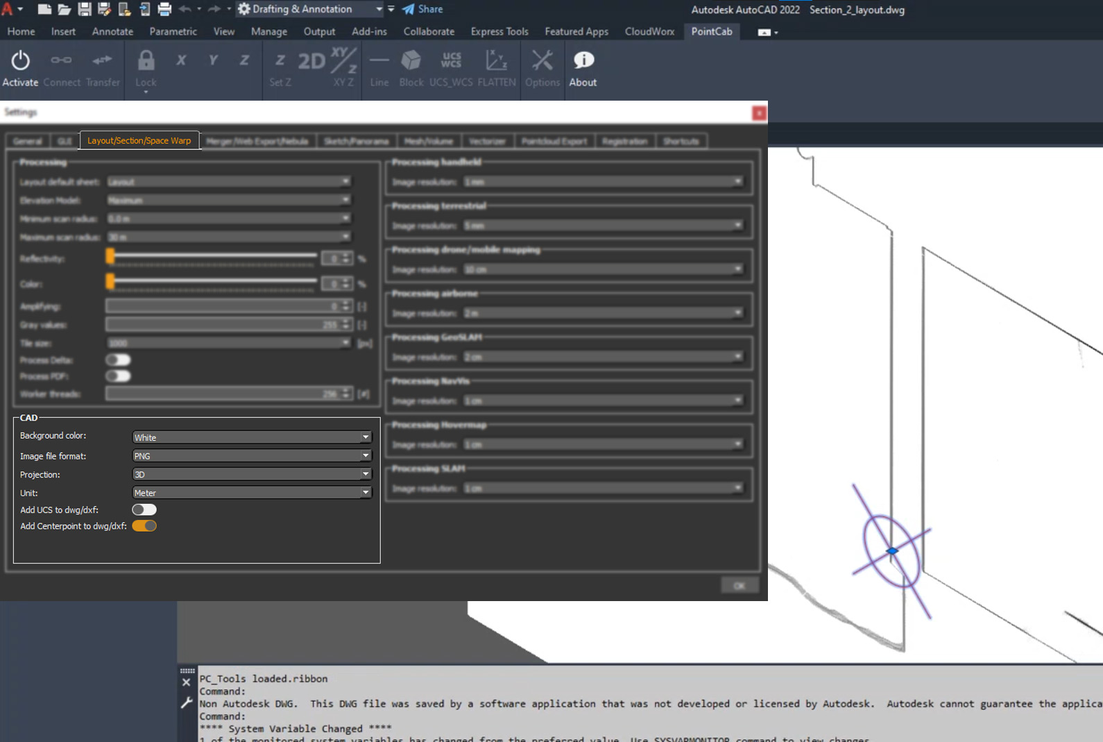
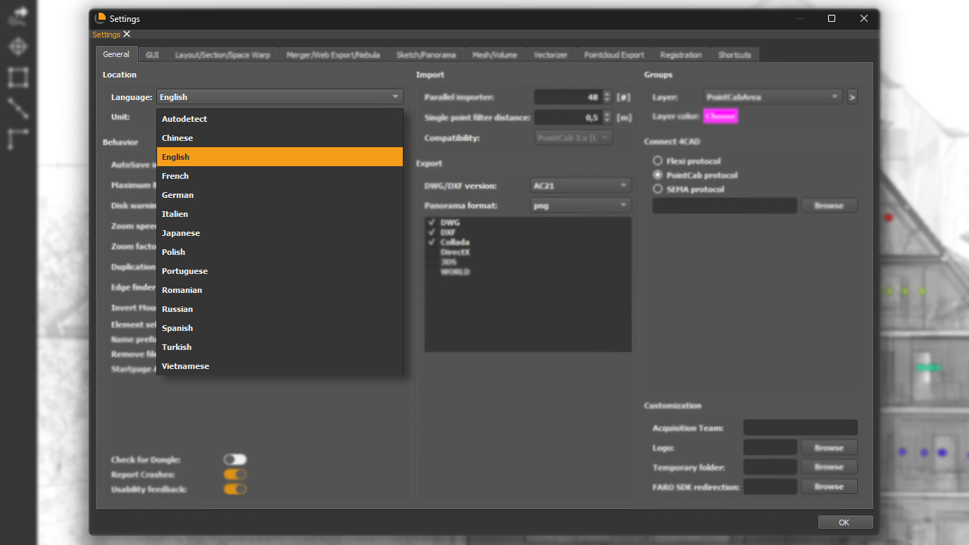
Language Settings moved
How it’s done?
Struggle to change Origins to your preferred Language? You’ll now find all languages in the Settings Menu in Origins.
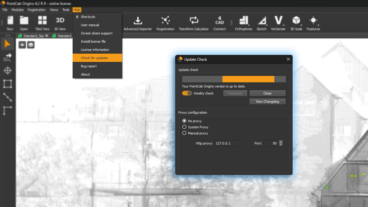
Automatic update for FARO API
What it’s for?
Origins now check automatically for the latest FARO API and suggest you to update it.
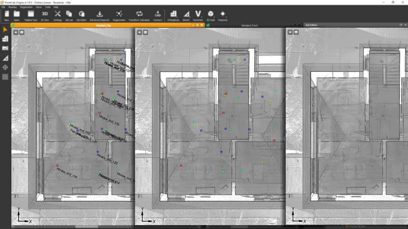
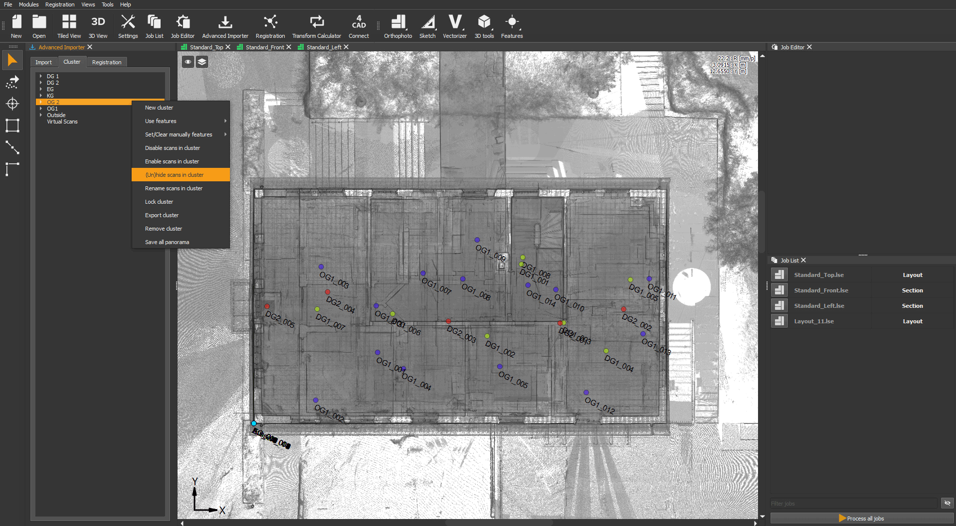
Hide scan positions in top view (customer request)💡
What it’s for?
Hide or unhide your scan positions by cluster in the top view.
How it’s done?
In the Advanced Importer select your cluster, open the menu with a right click and select un/hide scans to hide or unhide them.
Riegl SDK Update
What it’s for?
PointCab Origins 4.2 now supports all Riscan datasets.
EXTENDED DATA FORMATS – IMPORT / EXPORT
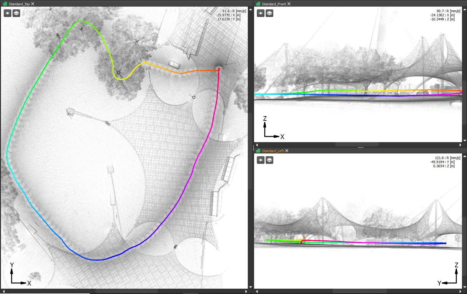
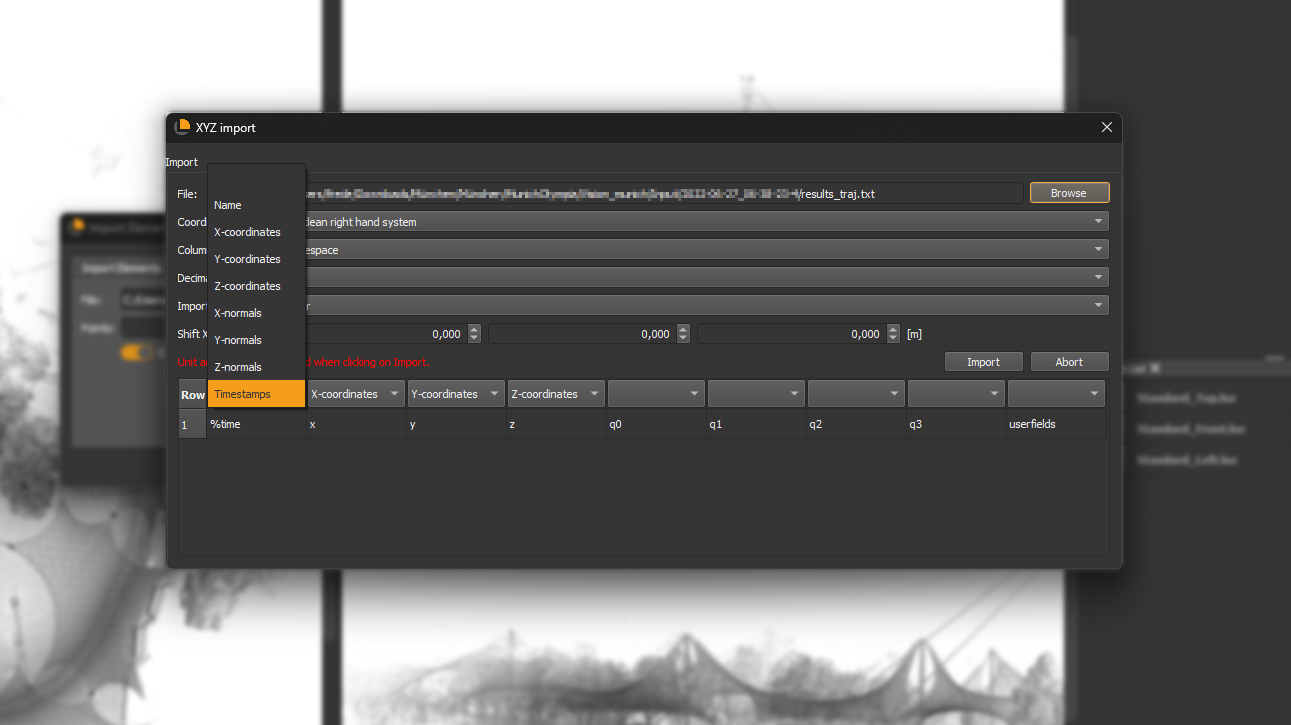
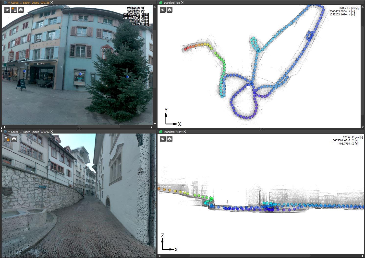
Trace your footsteps
What it’s for?
You can now import your trajectory files from Mobile Mapping Systems and beautifully visualize your path.
How it’s done?
Open “Import Elements” under Tools and choose “Import trajectory”. Browse your files to add your XYZ coordinates from the traj.txt file. Adjust the data types like in this example and you are ready to go!
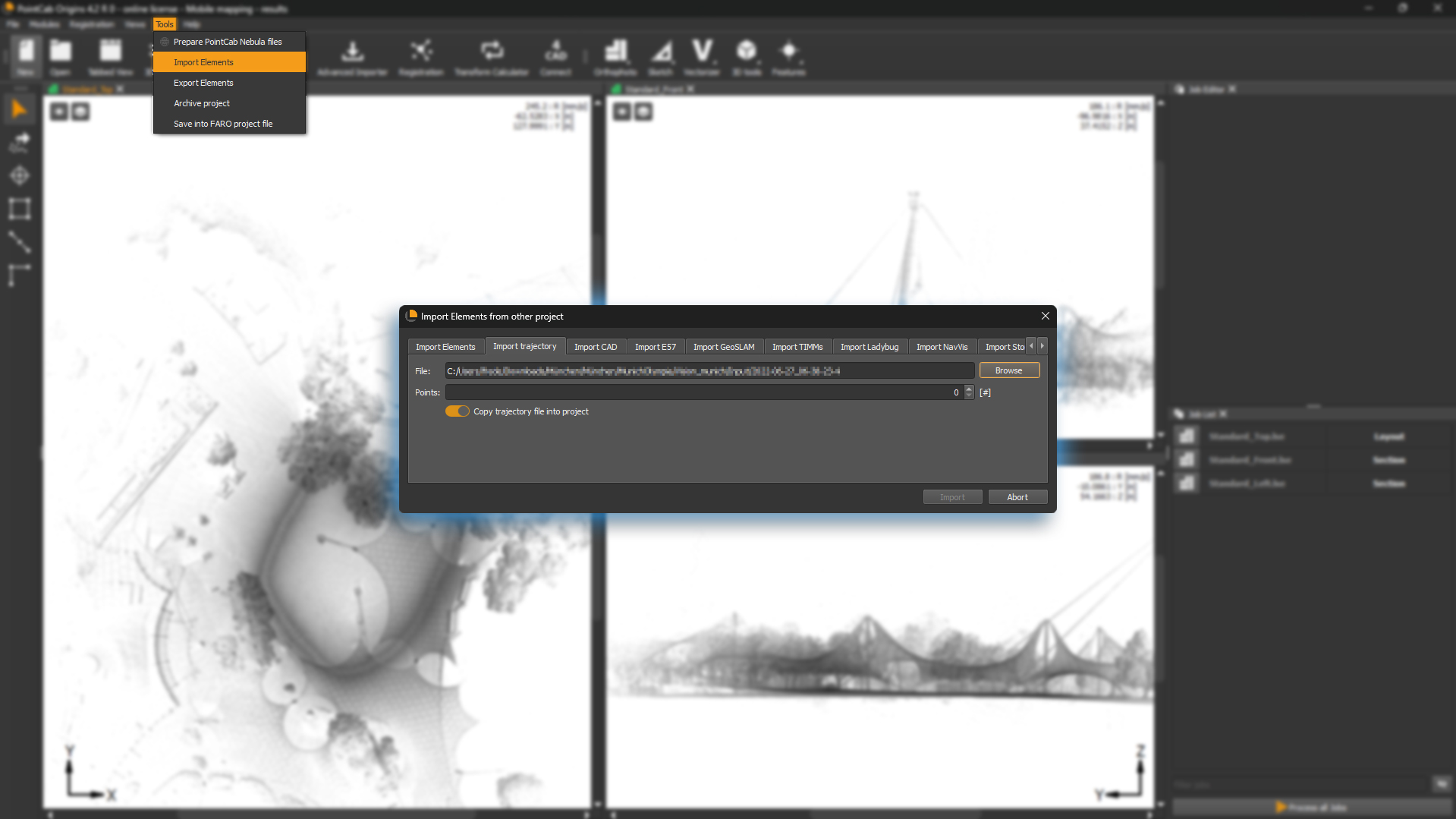
Click to enlarge the picture
Import Ladybug panoramas (customer request)💡
What it’s for?
Now you can import your Ladybug panoramas into PointCab Origins.
How it’s done?
Under “Import Elements” choose the “Import Ladybug” tab and start importing your Pano-Views!
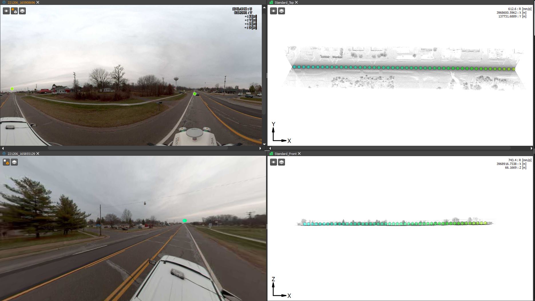
Click to enlarge the picture
Import Matterport panoramas (customer request)💡
What it’s for?
Now you can import your Matterport panoramas into PointCab Origins.
How it’s done?
When importing Matterport files, the panoramas are imported directly (no need to go to Import Elements – Import e57).
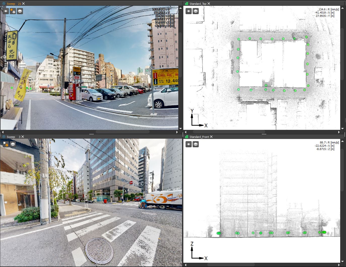
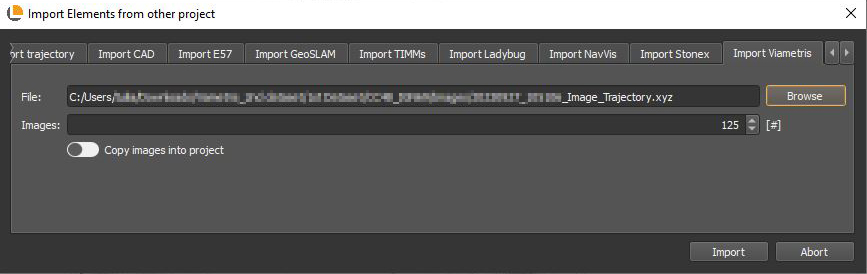
Import Viametris panoramas
What it’s for?
Now you can import your Viametris panoramas into PointCab Origins.
How it’s done?
Under “Import Elements” choose the “Import Viametris” tab and start importing your pano-views!
Click to enlarge the picture
BUG FIXES
- .e57 files can now be imported from Leica.
- Fixed a problem with Merger scale.
- Fixed an issue with the context menu for planes.