As-built documentation of a planetarium

blank

Using LIDAR technology for as-built documentation of a planetarium

blank

Thanks to the use of laser scanning and PointCab Origins Pro, placing new projectors is no longer a problem

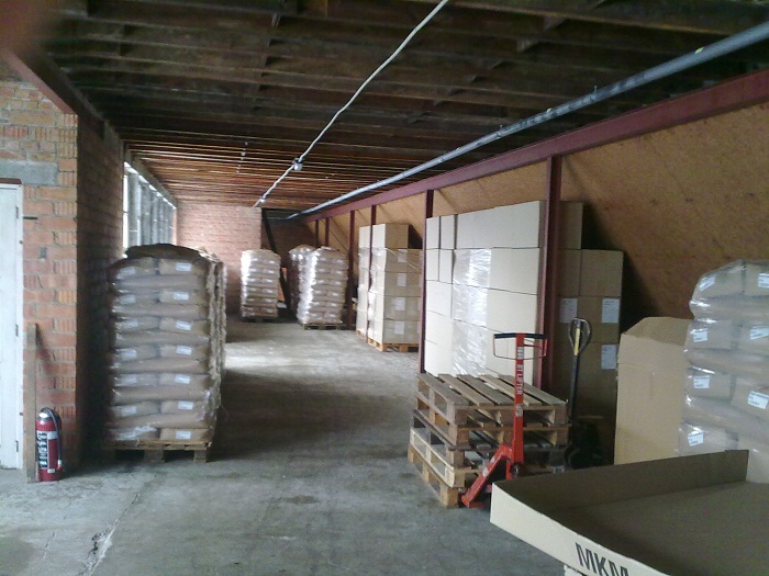
The precise placement of projectors in specially designed theatre rooms within planetariums is no easy task. Just measuring these rooms, which have sloping floors and domes, is a challenge. In addition, the measurement results and the design proposals derived from them must be communicated clearly and concisely to all project participants.

In the USA, the professionals from Seiler Instrument, more precisely Seiler’s Planetarium Division, are often called in for such jobs. Seiler employee Howard George used to use a combination of manual measurements and a total station for this task- a very time-consuming process. To speed up and simplify the process, laser scanning and PointCab’s point cloud software were therefore used for the first time.

The first step was to employ a handheld GeoSLAM ZEB Revo RT LiDAR scanner that creates 3D point clouds literally in minutes. Then the challenge was to efficiently extract the geometry and features to create BIM models of the spaces and better communicate the design intent to project stakeholders. To achieve this, Howard was provided with a trial version of PointCab 3D Pro (now Origins Pro). This is an easy-to-use point cloud editing and sharing software that was recommended by the Design Solutions team at Seiler. Howard comments, “In non-orthogonal areas like planetariums, PointCab allows me to freely tilt, rotate and magnify data points and orient perspectives. ” Thanks to the PointCab and Revit support, as well as online resources, Howard was able to start modelling from the point cloud within a few days, even as a novice, thanks to PointCab`s 4Revit plugin. This allowed him to simulate the placement of the projectors as-is and quickly create vectorised CAD schematics of the space and installation details. He was thrilled: “PointCab’s software exports 2D images of 3D spaces, but screen sharing the software via Zoom or simply forwarding my results with PointCab Share allows me to walk anyone through my process and show them whatever they want to see.” 

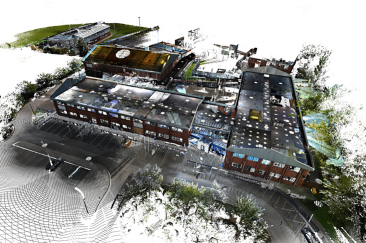
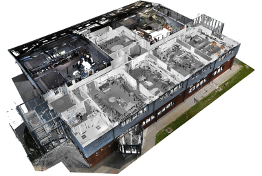
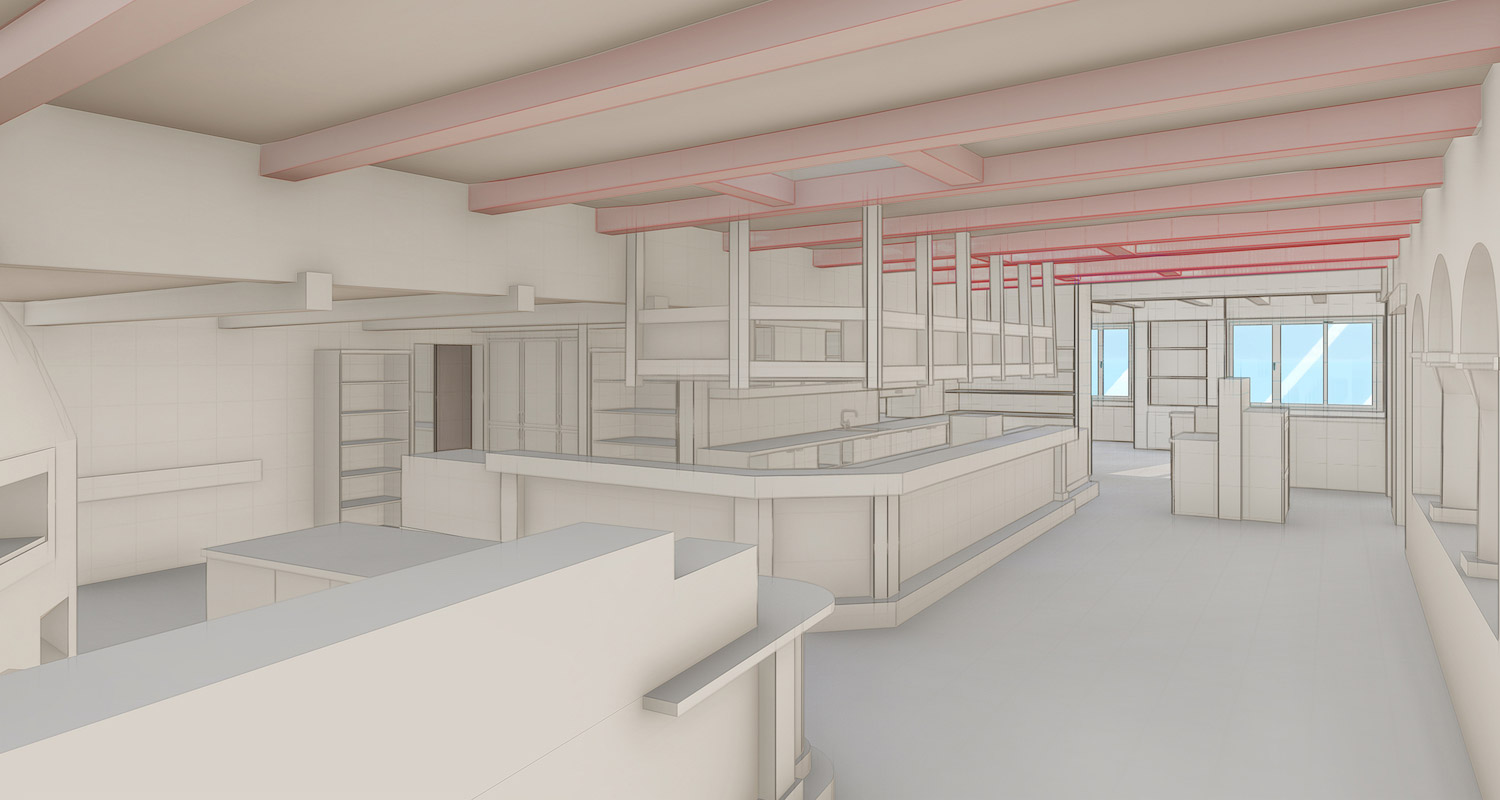
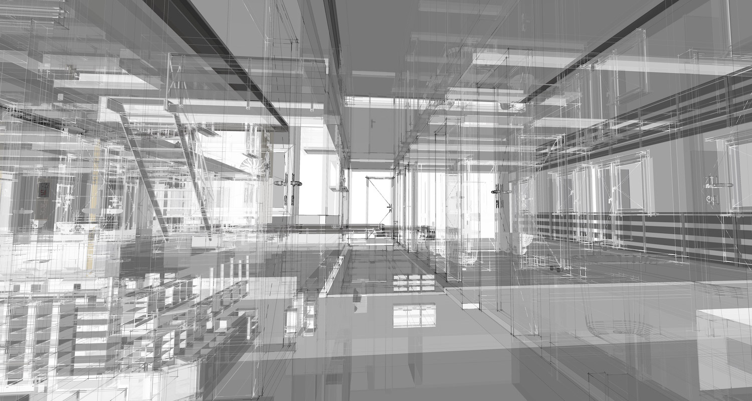
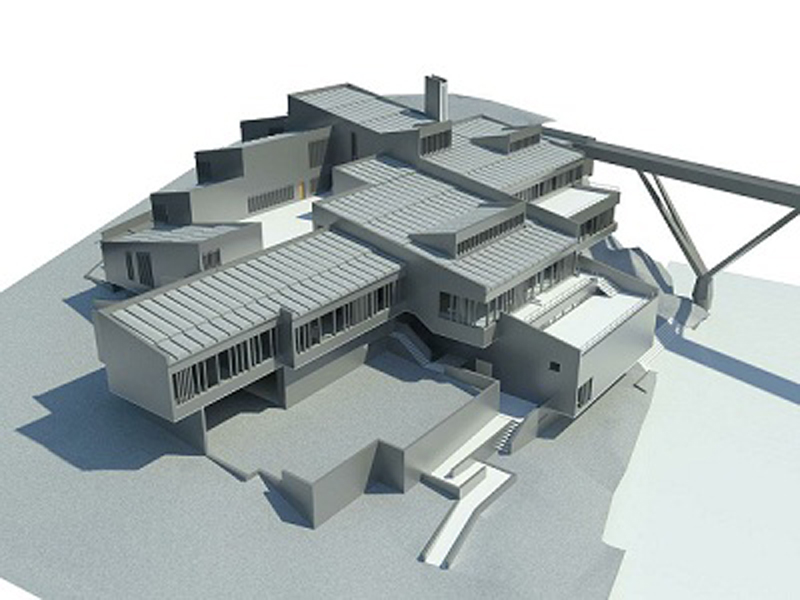
Verschiedene Evaluationen in Origins Pro

blank

The powerful combination of LiDAR scanning technology and PointCab Origins Pro has had a profound impact on the schedule and customer experience for these complex projector installations. Howard says: “I’m given metric spherical coordinates from ZEISS  to place projectors in relation to the dome. In PointCab, I export Cartesian imperial coordinates to place the projector stands on the floor.  Then the PointCab software exports 2D images of 3D spaces to me. Sharing data via PointCab Share (freeware) or screen sharing via Zoom allows me to share each step of the process with everyone and show in detail what is of interest.” In just one week, essential but very time-consuming tasks were thus radically reduced and changed for the better for everyone involved in the project. Once tested, the Seiler Planetarium Division would like to continue to rely on the combination of laser scanning and the PointCab software in the future.

Conversion of a former mustard factory

Senffabrik

From mustard factory to residential building

In this application, an existing old mustard factory was to be converted into a residential building. The two-story, U-shaped building contained various rooms full of production machinery, storage rooms and garages.

A digital survey of the property was imperative for highly accurate as-built plans. The specific task was to deliver floor plans and sections as CAD plans to the planning office cost-effectively and at short notice.

What exactly was it about? The purpose was the conversion of an existing old mustard factory. As is often the case, no current as-built plans were available. The complete acquisition of the object by means of 3D laser scanning, took 1/2 day. The result was 30 3D laser scans. Subsequently, floor plans and sections were created in PointCab Origins. Based on the evaluations created with PointCab Origins, the investment volume could be estimated. The duration of the data evaluation was only two hours.  Subsequently, the floor plans were imported into the customer’s CAD system. This provided a data basis for preliminary planning, design planning and final planning. In addition, the data could be used as a visualization basis for the creation of the apartment exposé.

WHY POINTCAB ORIGINS?

Software Speed

Even the most extensive point cloud data can be evaluated easily and quickly with PointCab Origins.

Direct workflow to CAD software

The information from the evaluated point cloud data can be easily and quickly transferred to CAD software.

Proximity to support

PointCab’s support is characterized by comprehensive expertise and individual attention.

The duration of the data evaluation took only 2 hours, which really surprised me!
Staff Bouwsupport
Jun. 2013

About BouwSupport

BouwSupport began in 1996 as an independent company that grew out of an existing architectural firm. Pre-construction and construction processes are part of our core competencies. You as architect or client provide the design or specification drawings, we prepare the specifications and working drawings. In the further course we can also take care of the complete or partial construction coordination.
BouwSupport

Acquisition of a high school

blank

New construction and modernization of a high school on the west coast of England

For the new construction and modernization of Skegness Academy, a high school in Lincolnshire on the west coast of England, an accurate as-built model was required.

In order to obtain the exact dimensions of the high school, the FARO Photon 120 laser scanner was used, which can capture up to 990,000 points per second. With the help of reference points in the individual scans, they could later be merged. The scans were then used to generate a dimensionally accurate point cloud that provided an accurate 3D model of the building.

For the project, PointCab Origins was used to create elevations and sections, as well as detailed, dimensionally accurate images. This allowed various views of the high school to be generated and read into Autodesk Revit. A complete 3D model was then created with just the click of a button.

The FARO Photon 120 delivered 230 scans here. Images of the entire site and the building from the inside were taken. The views were imported into Autodesk Revit. From this data, a highly accurate 3D model of the building was created.
What advantage did PointCab Origins bring here? The fully automatic generation of views and sections. Likewise, accurate and true-to-scale images were used here. The further processing of the scan data in the CAD system was also possible without plug-ins thanks to PointCab Origins. This provided the optimal basis for modeling, visualization, processing and simulation.

WHY POINTCAB ORIGINS?

Software Speed

Even the most extensive point cloud data can be evaluated easily and quickly with PointCab Origins.

Direct workflow to Revit

The information of the evaluated point cloud data can be easily and quickly transferred to Revit.

Proximity to support

PointCab’s support is characterized by comprehensive expertise and individual attention.

We think PointCab Origins is the fastest way to extract plans and sections from point clouds.
Eric Bergholz
CEO Laserscanning Europe
Jun. 2013

About Laserscanning Europe GmbH

Laserscanning Europe is the leading system company for 3D laser scanning. As an independent and experienced partner, we can offer our customers the best project solution for their application.

By renting and selling laser scanning hardware, software and accessories, we provide our customers with the required tools for their projects. In our training courses, we share our know-how and many years of experience from various projects. On demand, we support our customers with data collection by means of 3D scanners, analysis of scan data and modeling.

https://www.laserscanning-europe.com

BIM model of a hotel in St. Moritz

blank

From scan to BIM on the fly – HMQ scans luxury hotel in St. Moritz

The Hotel Sonne in St. Moritz is a popular destination for skiing and Welness vacationers. To prepare the hotel for the future, HMQ AG was commissioned to generate a comprehensive 3D building model of all interior spaces and the exterior facade. The 3D point cloud data was required for further processing in Graphisoft Archicad to create a complete BIM model.

Right from the start, the project included a major challenge: the acquisition of the hotel with laser scanners from FARO had to take place during the peak winter season and also during ongoing guest operations. The entire building therefore had to be captured as quickly as possible and without major disruption to guests. In the interior, a floor area of 1,100 m² had to be surveyed, distributed over three floors and a building height of approx. 10 meters. Outside, the work was no easier. The snow lying at the time of the project, which is why vacationers primarily traveled to St. Moritz, made the scans of the facade difficult.

HMQ, however, managed all challenges and had a huge amount of point cloud data from around 500 scans after only 72 hours. HMQ has been using Archicad 21 software to create BIM models for some time. To be able to use the point cloud data for processing in Archicad, HMQ uses PointCab Origins. More specifically, use the 4BIMm plugin, which allows the point clouds to be analyzed and the information seamlessly transferred into ArchiCAD. This reduced time for HMQ and, consequently, project costs. Putting all this together, the result was a relaxed project process for everyone involved. This can only be beneficial for a vacation hotel.

The basis for this is the uniquely fast processing of the most extensive point clouds in PointCab Origins. Ease of use was the main focus when Christian Vetsch, Managing Director at HMQ together with his team decided to use PointCab Origins three years ago. The great compatibility with all scanner types and makes made the decision even easier for HMQ.

“We chose PointCab Origins because the software is easy and intuitive to use and is constantly being developed,” says Christian Vetsch. If you ask HMQ employees, they also appreciate the uncomplicated proximity to PointCab support.

WHY POINTCAB ORIGINS?

Software Speed

Even the most extensive point cloud data can be evaluated easily and quickly with PointCab Origins.

Direct workflow to ArchiCAD

The information of the evaluated point cloud data can be easily and quickly transferred to Graphisoft ArchiCAD.

Proximity to support

PointCab’s support is characterized by comprehensive expertise and individual attention.

We chose PointCab Origins because the software is easy and intuitive to use and is constantly being developed
Christian Vetsch
Managing Director HMQ AG
Dez. 2018

About HMQ AG

HMQ AG, based in the cantons of Graubünden, Zurich and Aargau, is one of the leading Swiss engineering and planning companies.
The core competencies of the engineers, planners and consultants of the HMQ Group lie in the specialist areas of surveying, construction and planning. To ensure customer satisfaction as well as to offer employees an exciting work environment, HMQ AG builds on innovation, quality and technology.
To the HMQ AG website: http://hmq.ch/

Acquisition of factory halls

uni_siegen

University of Siegen in the capture of factory halls - architecture

The Interdisciplinary Competence Center for Old Buildings (InKA) of the University of Siegen realized the registration of a complete industrial plant with the help of laser scanning. This involved a built-up area of approx. 10,000 m². All supply and disposal lines had to be documented, which meant that a relatively large number of scans were required. The goal of the scanning and documentation was the 3D modeling of the work in the CAD system ArchiCAD. As a basis for this, floor plans and sections were generated through the total point cloud.

The area to be scanned in this project covered approx. 10,000 m², which were captured with a FARO Photon 80. The final result was 80 scans with a total data volume of approx. 7 GB. The subsequent modeling was to be done in Graphisoft ArchiCAD. How did PointCab Origins come into play at this point? Well, in the end it was possible to define sections at any point of the scans. The final product was a scaled pixel image with an accuracy of up to two millimeters per pixel. PointCab Origins then reduced the amount of data to a manageable size for CAD systems. Thus, the data output format was easily readable by all CAD systems commonly available on the market. By distributing the cut through the point cloud to several pixel files, the so-called “tiling”, the amount of data to be exported can be conveniently adapted for the respective CAD system. A huge advantage!

WHY POINTCAB ORIGINS?

Software speed

Even the most extensive point cloud data can be evaluated easily and quickly with PointCab Origins.

Direct workflow to ArchiCAD

The information of the evaluated point cloud data can be easily and quickly transferred to Graphisoft ArchiCAD.

Proximity to support

PointCab’s support is characterized by comprehensive expertise and individual attention.

The PointCab Origins plans can be easily processed in ArchiCAD without additional software.
University of Siegen
Jun. 2013

About Siegen University

The University of Siegen is a medium-sized, interdisciplinary research university. It is firmly rooted in the region of South Westphalia and widely networked both nationally and internationally. With its research and teaching, it wants to contribute to a future that is oriented towards people and characterized by responsibility for society. This is expressed in the guiding principle of the University of Siegen: Shaping the future in a humane way.

https://www.uni-siegen.de/start/

As-built documentation of an old house

blank

Preparation of remediation concepts - Swiss Canton Ticinio

As part of a project by Pastorelli SA, an old house in the center of a village in the Swiss canton of Ticino was to be surveyed. Thus, detailed plans of the building were to be created. The purpose of the project was to be able to use the plans to create renovation concepts in the ArchiCAD software. Since there were no current and reliable plans of the building, a modern measuring method was used: 3D laser scanning.

The engineering firm Pastorelli SA, based in Lugano (Switzerland), used the FARO Photon 120 laser scanner for this purpose. Three facades and the four floors of the house were recorded. The scanner was placed inside the house to scan the basement, the roof and the two floors in between. Outside, it was set up to capture the facades. This resulted in a total of 29 scans within 6 hours. Three employees were involved in the process. The created scans were registered with the software FARO Scene. The point clouds were merged into one large point cloud. This point cloud contains all measuring points of the object.

With the help of PointCab Origins, four floor plans, three façade plans and 20 sections could be extracted automatically. The orthophotos could be exported for use in various CAD systems. Since Pastorelli SA’s client wanted to perform the renovation plans in ArchiCAD software, PointCab Origins was an excellent solution for preparing the data. It was possible to quickly generate the required plans automatically and then create any sections. In this way, the data could then be easily used in the ArchiCAD CAD system. Finally, the data set obtained was conveniently handed over via USB stick.  In total, the data processing took about 8 hours.

WHY POINTCAB ORIGINS?

Software speed

Even the most extensive point cloud data can be evaluated easily and quickly with PointCab Origins.

Direkt Workflow to ArchiCAD

The information of the evaluated point cloud data can be easily and quickly transferred to Graphisoft ArchiCAD.

Proximity to support

PointCab’s support is characterized by comprehensive expertise and individual attention.

Point clouds are for engineers, plans for architects. PointCab Origins is the fastest connection between them.
Marzio Righitto
Engineer - Pastorelli SA
Dez. 2018

About Geomatica Righitto (formerly Pastorelli SA)

The engineering firm Pastorelli SA, with headquarters in Lugano (Switzerland)http://www.righitto.ch

Surveying Dunelm House

dunelm house

Surveying Dunelm House - home of the Durham Univerity Students' Union (DSU)

Worcester, UK-based Bury Associates Ltd was contracted to survey Dunelm House, home of the Durham Students’ Union (DSU) at Durham University. With the roof leaking in many places, Dunelm House needed to be repaired quickly. As a result, Durham University decided to undertake a major renovation. In order to create a highly accurate 3D model and numerous plans in Revit, the building and the surrounding area were scanned with two FARO Focus3D laser scanners. Using total stations and GPS, the team was also able to capture topographical information in the process.

Since Dunelm House was built on the banks of the River Wear and the roof is characterized by a special shape, the sometimes very complicated geometries had to be comprehensively recorded. Thus, 3D laser scanning provided an excellent method for the detailed measurement of the building. The surveying process delivered very accurate data within a very short time. In only four days, numerous images or orthophotos could be extracted from the scan data (point cloud) in Pointcab. These images were used for the creation of plans, elevations, sections and BIM as well as for the generation of 2D plans in AutoCAD.

WHY POINTCAB ORIGINS?

Software speed

Even the most extensive point cloud data can be evaluated easily and quickly with PointCab Origins.

Direkt Workflow to Revit

The information of the evaluated point cloud data can be easily and quickly transferred to Revit.

Proximity to support

PointCab’s support is characterized by comprehensive expertise and individual attention.

We think PointCab Origins is the fastest way to extract plans and sections from point clouds.
Bury Associates Limited
Dez. 2018

About Bury Associates Limited

Bury Associates Limited was established in 1997 by Steve Bury. His aim was to provide a top quality service to clients needing topographical and measured building surveys throughout the UK. The company has grown steadily over the years and now includes surveyors, drone pilots, CAD operators, dedicated BIM specialists and administrative staff. “We pride ourselves on being an innovative company. We always use the latest and best survey equipment available and provide an excellent customer service.” Steve Bury, MD Bury Associates use the latest drones, robotic survey instruments and laser scanners. This allows even large sites to be surveyed extremely quickly and accurately. Surveys are enhanced by using network GPS to place projects onto precise Ordnance Survey co-ordinates and datum. 3D data has formed an important part of the company’s output right from the start – from the 3D AutoCAD models produced in the late 1990s of the M5/M6 interchange through to today’s highly detailed Revit Building Information Models. We supply these to some of the UK’s leading architects and engineers. https://www.buryassociates.co.uk/