USER STORY
Acquisition of Factory Halls:
3D Laser Scanning for Complete Documentation

As part of a major industrial documentation project, the Interdisciplinary Competence Center for Old Buildings (InKA) of the University of Siegen carried out a full 3D laser scanning of factory halls covering approximately 10,000 m². The goal was to create reliable documentation for subsequent CAD modeling and planning in Graphisoft ArchiCAD.
Why Detailed Factory Acquisition Matters
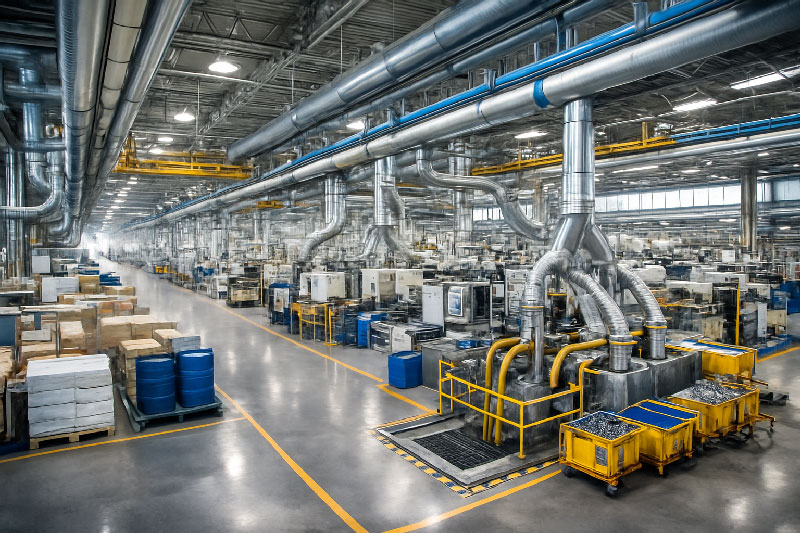
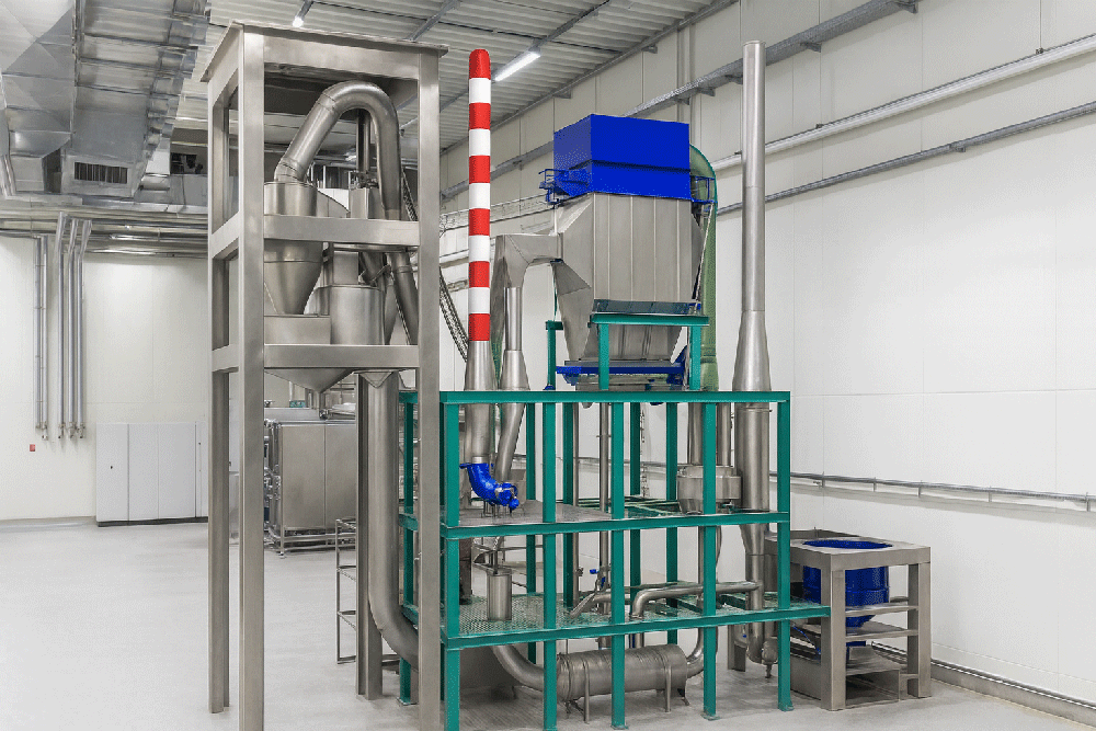
Large factory halls and industrial plants contain extensive structural geometry as well as supply and disposal lines, machinery, and installations. Without precise as-built data, even well-intended renovation, retrofitting, or layout planning can suffer from:
- geometry mismatches between the physical structure and the existing drawings
- misaligned equipment due to outdated plans
- planning delays due to manual re-measuring on-site
A modern 3D laser scan provides an accurate, coherent representation of the facility that eliminates guesswork and supports efficient engineering and design.
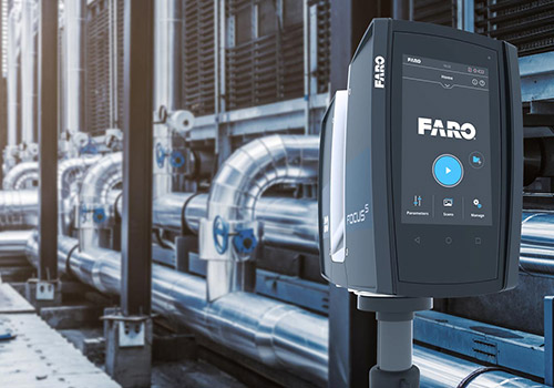
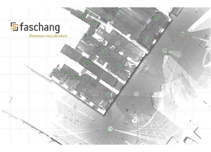
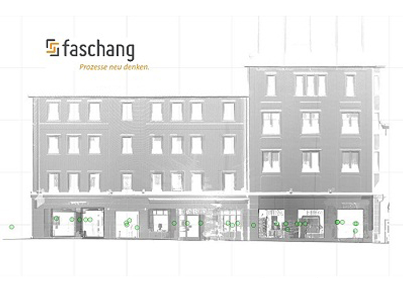
How the Factory Halls Were Surveyed: FARO Photon 80 and Point Cloud Capture
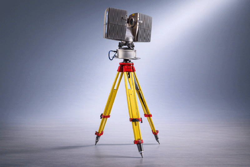
The survey covered approximately 10,000 m², using a FARO Photon 80 laser scanner.
- Total scans: 80
- Total data volume: approx. 70 GB
- Geometry captured: complete interior of the factory halls and all supply/disposal lines
This dense set of scans ensured full coverage and detailed capture of the existing infrastructure — even in areas with complex pipework or machinery.
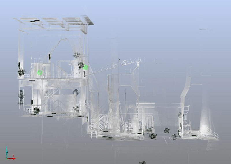
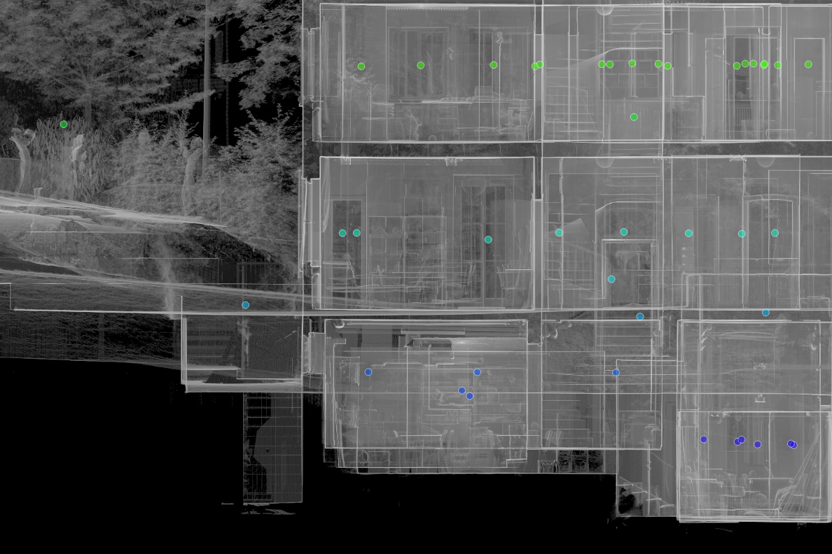
Point Cloud Registration in FARO Scene
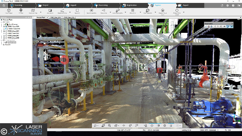
All individual scans were registered and merged using FARO Scene to produce a unified point cloud. This step ensures:
- correct alignment across all scans
- a single 3D dataset covering the entire facility
- consistent coordinate referencing for export and further processing
A unified point cloud is the foundation for accurate plan extraction, CAD modeling and coordination between engineering teams.
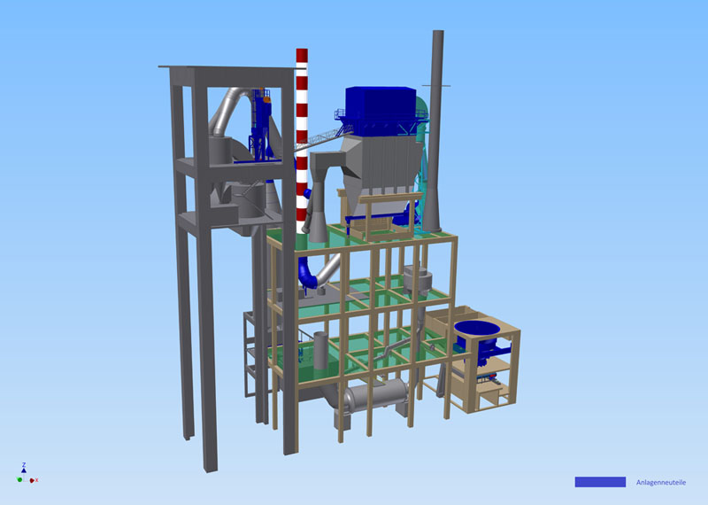
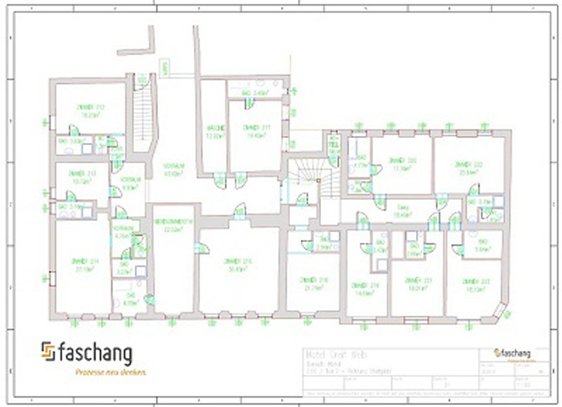
Deriving Accurate Plans and Sections from the Point Cloud
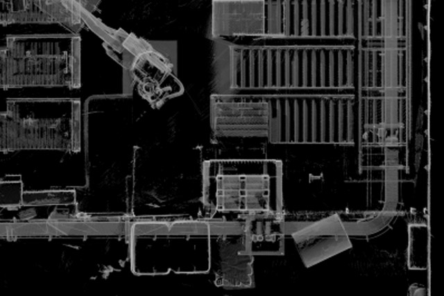
Once registered, the point cloud was evaluated in PointCab Origins. The software enabled rapid extraction of 2D plans and sections at any desired position through the point cloud. These derived outputs consisted of:
- orthographic images scaled to real dimensions
- tiling across multiple files to adapt the export size for different CAD systems
- export formats readable by all major CAD/BIM platforms
PointCab Origins reduced the raw data to manageable file sizes without sacrificing accuracy, which made it possible to transfer directly into Graphisoft ArchiCAD for further modeling.
Why 3D Acquisition Is Valuable for Industrial Facilities
This case highlights the core strengths of laser scanning in industrial environments:
- Complete coverage: Includes structural elements, machinery, and services in a single dataset.
- High accuracy: Up to 2 mm per pixel in scaled outputs allows precise modeling.
- Flexible export: Tiling and export options make datasets usable in virtually all CAD systems.
- Faster workflows: Engineers and planners can start modeling directly from evaluated scans, saving time and reducing rework.
For production halls, large plants, or technical facilities, 3D laser scanning is now considered a standard method for creating trustworthy as-built documentation that supports engineering, renovation, and expansion projects.
Want to keep up with the latest pointCab news?
Then follow us on Social Media or subcribe to our newsletter!