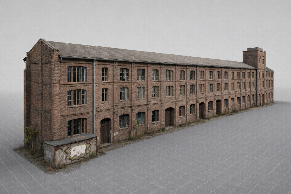
Conversion of a former mustard factory

Senffabrik von außen

The Challenge: No Existing Floor Plans and Time-Sensitive Planning

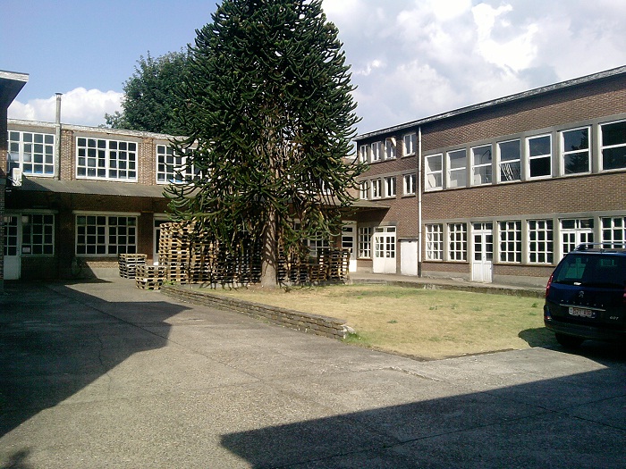
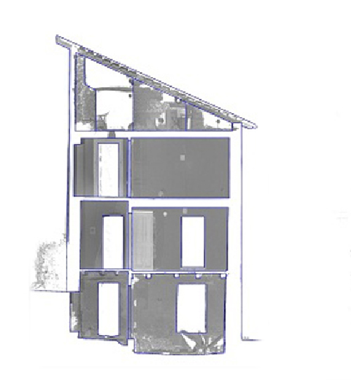
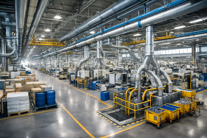
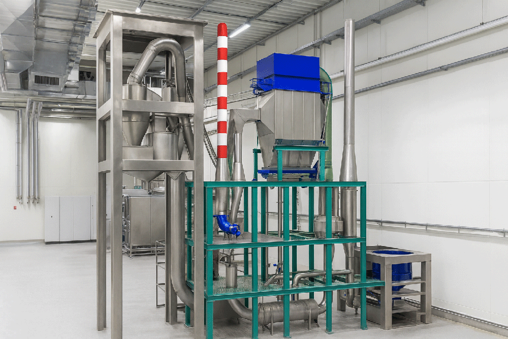
In this project, an old mustard factory was being converted into a residential building. The two-story, U-shaped structure contained former production rooms, storage areas and garages – but no current, reliable as-built plans were available for this complex task. 3D laser scanning provided the precise documentation needed for planning and design.

Converting an industrial building into residential space requires accurate knowledge of existing conditions. Without updated plans, planners and engineers risk costly errors during design and construction. In this case, the goal was to produce detailed floor plans and sections as CAD deliverables for the planning office – efficiently and within a short timeframe.

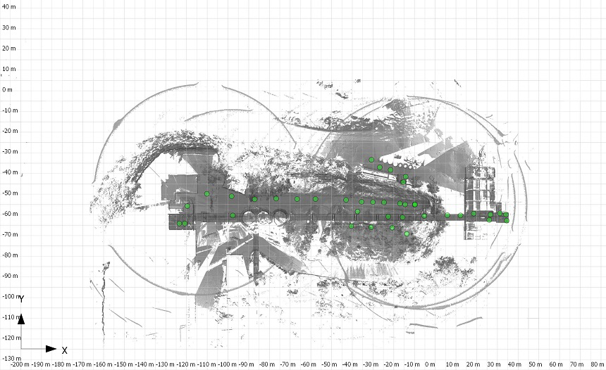
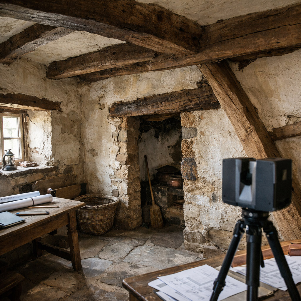
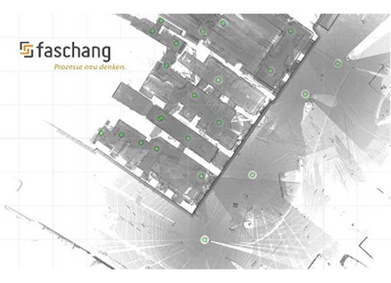
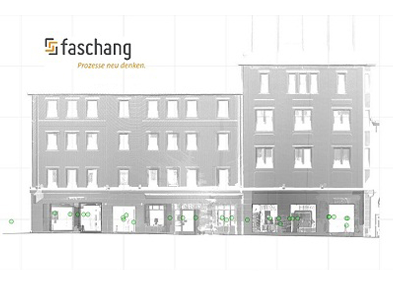
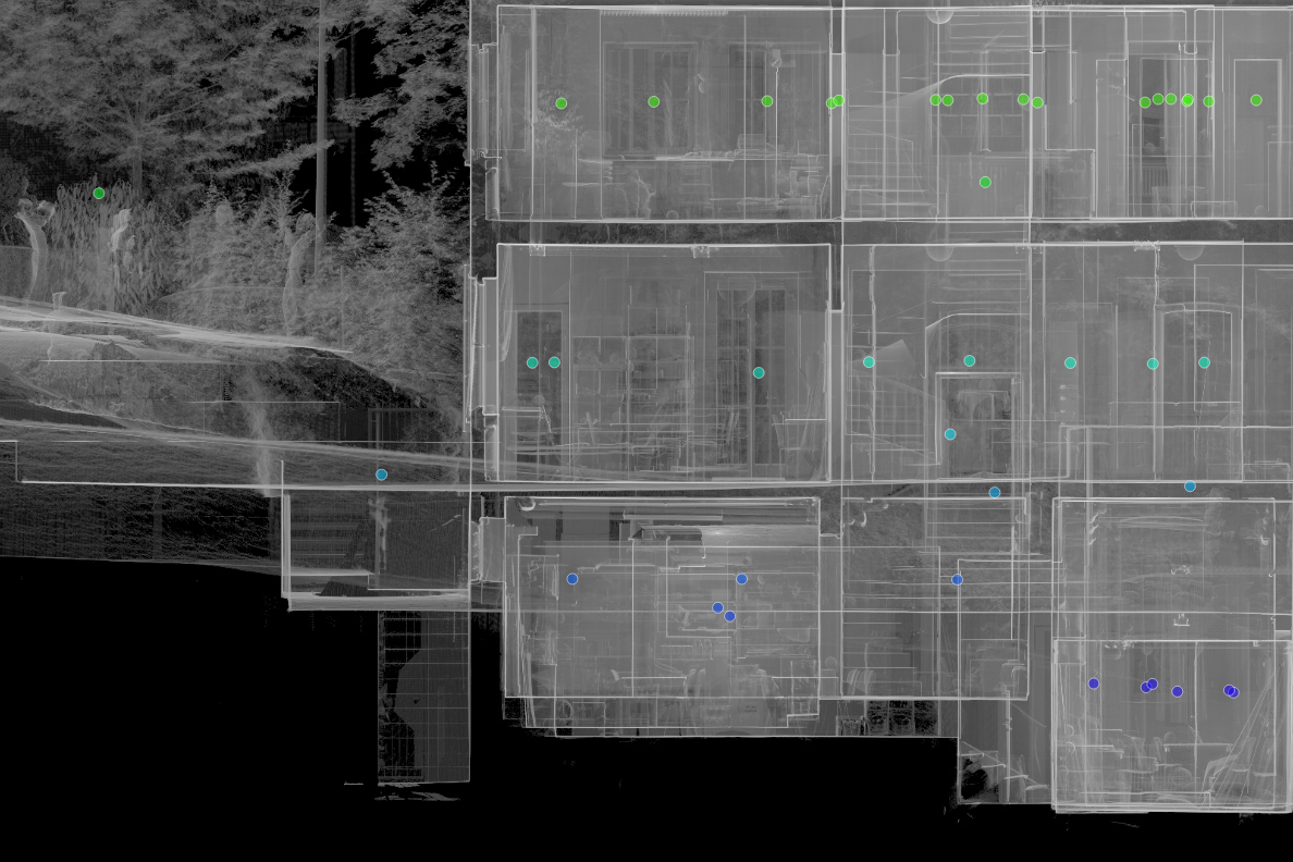
Capturing the Existing Building: Fast and Complete 3D Laser Scanning

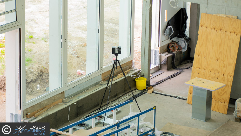
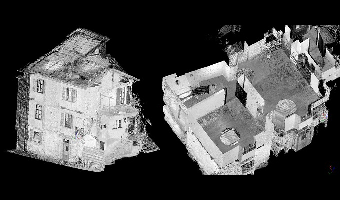
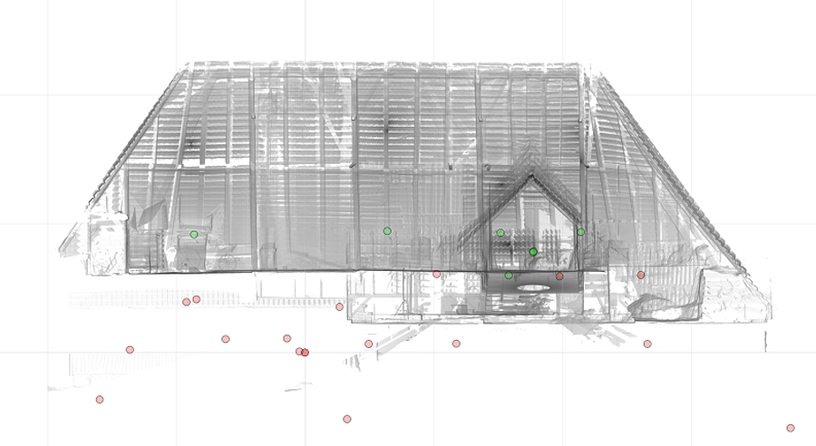
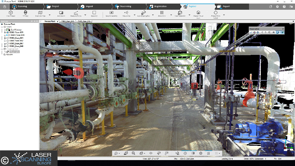
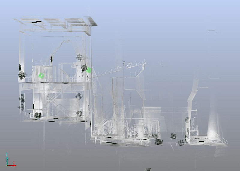
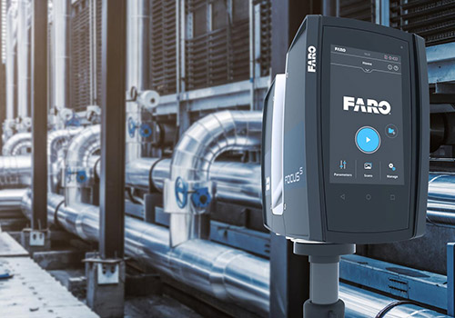
The entire building was documented using 3D laser scanning within half a day. A total of 30 individual scans were carried out, capturing all relevant rooms, walls, openings and structural elements.
This approach delivered a complete and detailed point cloud representing the actual condition of the building – an essential foundation when converting industrial structures into residential use.

Die Datenauswertung hat nur 2 Stunden geadauert, was mich wirklich überrascht hat!
Mitarbeiter Bouwsupport
Jun. 2013

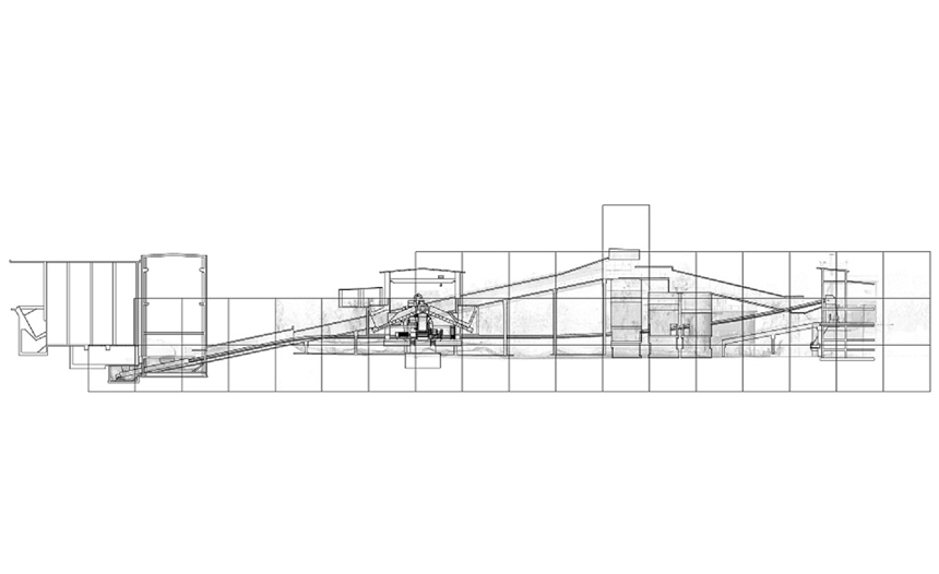
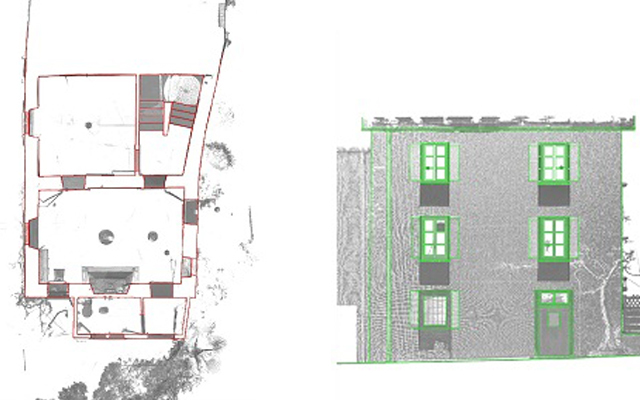
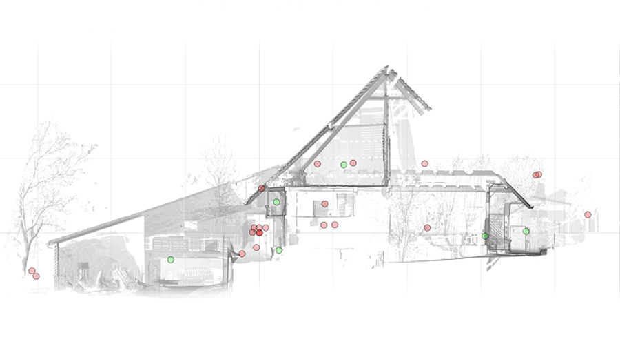
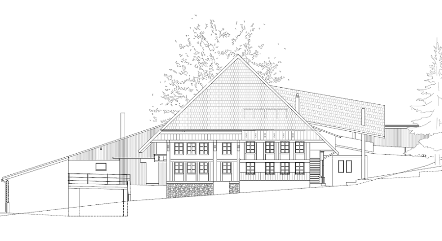
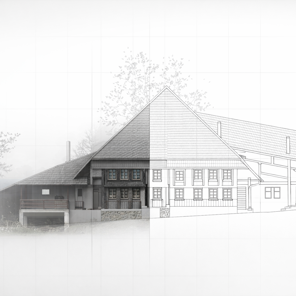
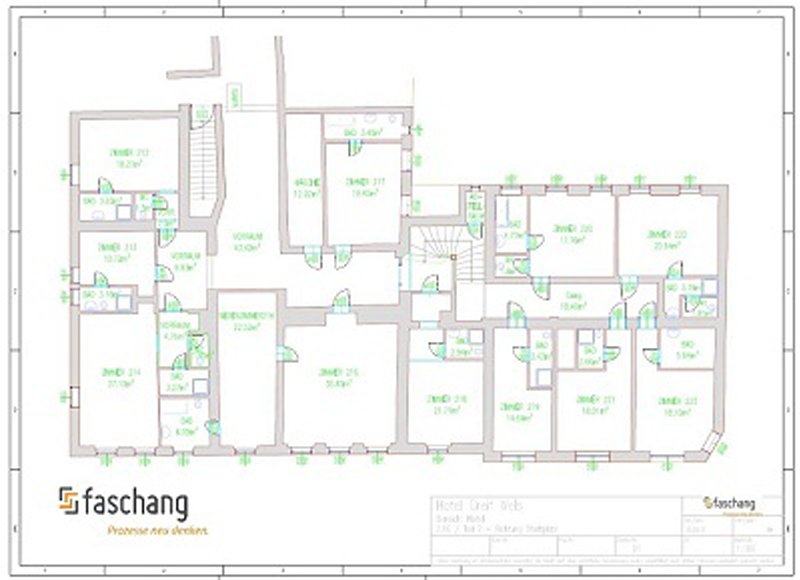
From Point Cloud to CAD Plans: Efficient Evaluation with PointCab Origins

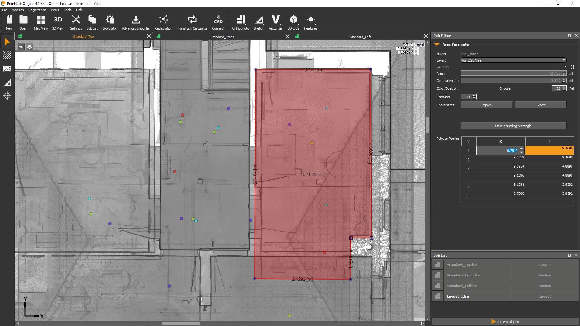
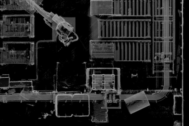
After data acquisition, the point cloud was evaluated using PointCab Origins. From the scan data, the required deliverables were derived efficiently:

  • floor plans,
  • cross sections,
  • and scaled, CAD-ready drawings.

The generated data could be imported directly into the customer’s CAD system and used for further planning steps without additional re-measurement or manual reconstruction.

Planning Benefits and Project Outcomes

The complete evaluation process – from raw scan data to exportable plans took approximately two hours.
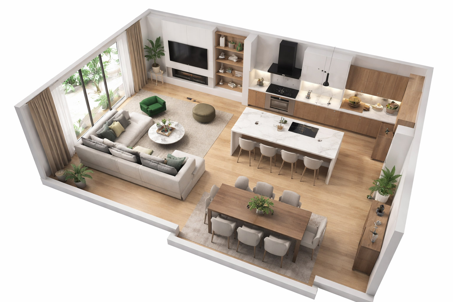
Based on the generated plans, the investment volume for the conversion could be assessed quickly and reliably. The resulting CAD data supported:

  • preliminary and design planning,
  • detailed execution planning,
  • and visualizations for residential marketing and exposés.

This workflow provided a solid digital foundation for all subsequent project phases.

Want to keep up with the latest pointCab news?

Then follow us on Social Media or subcribe to our newsletter!

Facade elevation of a listed industrial building

blank

Requirements: Facade Documentation of Listed Building

In Magdeburg, a historic industrial building subject to preservation orders was undergoing conversion into residential loft apartments. To comply with heritage requirements and support renovation planning, highly accurate, true-to-scale documentation of the building’s facades was essential. Traditional measurement approaches were not feasible due to the narrow working space and the structure’s height, so a 3D laser scanning survey was commissioned. The 3D laser scanning survey, as well as the processing and modeling of the point cloud data was carried out by Laserscanning Europe.

Challenges of Capturing a Listed Facade

The building’s complex geometry presented multiple challenges:

  • The facades reach up to 17 m in height, making direct manual measurement risky and limited by space.
  • The east facade features multiple offsets and sloping sections, requiring detailed mapping to capture elements such as window surrounds and wall protrusions.
  • As a listed structure, all renovations must align with heritage preservation requirements, which demand accurate documentation of existing conditions before design can proceed.

These conditions made non-contact 3D laser scanning the only practical method to achieve comprehensive and precise data.

Survey Execution: 25 Scan Positions and Efficient Data Capture

The team performed a total of 25 laser scanner setups across the three principal facades, covering a facade area of 1,720 m². Only one surveyor was needed on site, and the total scanning time was approximately 5 hours.

The result was a dense and complete point cloud representing all facade details – including irregularities and features that are critical for both preservation and renovation planning.

The rapid creation of scaled orthophotos allowed for quick analysis in Geograf.
Eric Bergholz
CEO, Laserscanning Europe GmbH
Dez. 2018

From Point Cloud to Digital Plans Using PointCab Origins and Geograf

Once the laser scanning was completed, the raw point cloud data was processed with PointCab Origins:

  • True-to-scale orthophotos were generated automatically.
  • The orthophotos and extracted measurements were imported into the CAD system Geograf within one hour.
  • Detailed 2D plans, including facade drawings and crack documentation, were created at a 1:50 scale.

This workflow enabled architects and engineers to immediately begin modeling and detailed planning for renovation and conversion. The CAD deliverables supported both the artistic design and the technical compliance needed for a listed building.

Why Detailed Facade Documentation Matters for Preservation Projects

For any structure under heritage protection, understanding the existing condition – especially at high resolution – is vital:

  • Preservation orders require that original characteristics be respected in renovation.
  • Irregularities (cracks, offsets, sloping segments) must be precisely recorded before any intervention.
  • A digital record supports historical documentation and prevents speculative or inaccurate reconstruction.

By using 3D laser scanning and rapid orthophoto generation, the project team not only met the strict accuracy requirements but also sped up the planning process, saving time and reducing risk during subsequent project phases.

Want to keep up with the latest pointCab news?

Then follow us on Social Media or subcribe to our newsletter!

As-built documentation of an old house

As-Built Documentation of an Old House: Why a Complete 3D Laser Scan Was Essential

An old residential building in a village in the Swiss canton of Ticino lacked reliable, up-to-date building plans. To prepare renovation and restoration work, the engineering firm Geomatica Righitto (Lugano, Switzerland) was commissioned to do a full 3D as-built documentation.

Traditional plans were missing or outdated, and the building required precise measurements to support planning in CAD and BIM software.

Missing Plans, Irregular Geometry, and the Need for Precision

Older buildings rarely follow perfectly straight lines or standardized geometries. Over decades – or even centuries – walls may shift, floors may sag, and angles deviate from 90 degrees.

This means: assumptions based on symmetry or “standard” geometry can be highly misleading.

For renovation work, especially structural or restorative interventions, accurate data is crucial. Because no reliable plans existed for this house and its geometry was visibly irregular, a precise and complete measurement was essential, making 3D laser scanning the ideal method.

Survey: Faro Photon 120, Faro Scene, and Efficient On-Site Work

Geomatica Righitto used a FARO Photon 120 laser scanner to capture the entire building, including:

  • three façades,
  • the basement,
  • the roof,
  • and all four floors.

In total:

  • 29 scans,
  • 6 hours on site,
  • 3 survey specialists.

All scans were registered and merged in FARO Scene, ensuring correct alignment and a unified, consistent point cloud.

This point cloud became the complete digital representation of the building, including all the irregularities typical of older structures.

Point clouds are for engineers, plans for architects. PointCab Origins is the fastest connection between them.
Marzio Righitto
Engineer - Pastorelli SA
Dez. 2018

Processing the Point Cloud: Fast Extraction of Plans and Sections

Once the unified point cloud was ready, Geomatica Righitto used PointCab Origins to extract essential architectural outputs:

  • 4 floor plans
  • 3 façade plans
  • 20 building sections
  • Orthophotos for façades and interior walls

These automated extractions significantly reduced manual drafting work.
The final drawings — both as-built documentation and renovation plans — were delivered in a CAD/BIM-ready format for use in Archicad.

The entire processing workflow, including preparation for delivery, took about 8 hours.

What This Case Study Demonstrates

This project shows how even older buildings with irregular geometry and missing documentation can be comprehensively captured. Old buildings are rarely dimensionally perfect, but laser scanning captures reality exactly as it is, and the resulting point cloud becomes a trusted digital baseline.

The combination of FARO Photon 120, FARO Scene, and PointCab Origins enabled Geomatica Righitto to create reliable plans quickly –  giving architects and engineers the confidence they need to design renovations and restoration work effectively.

Want to keep up with the latest pointCab news?

Then follow us on Social Media or subcribe to our newsletter!

Acquisition of factory halls

USER STORY

Acquisition of Factory Halls:
3D Laser Scanning for Complete Documentation

As part of a major industrial documentation project, the Interdisciplinary Competence Center for Old Buildings (InKA) of the University of Siegen carried out a full 3D laser scanning of factory halls covering approximately 10,000 m². The goal was to create reliable documentation for subsequent CAD modeling and planning in Graphisoft ArchiCAD.

Why Detailed Factory Acquisition Matters

Large factory halls and industrial plants contain extensive structural geometry as well as supply and disposal lines, machinery, and installations. Without precise as-built data, even well-intended renovation, retrofitting, or layout planning can suffer from:

  • geometry mismatches between the physical structure and the existing drawings
  • misaligned equipment due to outdated plans
  • planning delays due to manual re-measuring on-site

A modern 3D laser scan provides an accurate, coherent representation of the facility that eliminates guesswork and supports efficient engineering and design.

How the Factory Halls Were Surveyed: FARO Photon 80 and Point Cloud Capture

The survey covered approximately 10,000 m², using a FARO Photon 80 laser scanner. 

  • Total scans: 80
  • Total data volume: approx. 70 GB
  • Geometry captured: complete interior of the factory halls and all supply/disposal lines

This dense set of scans ensured full coverage and detailed capture of the existing infrastructure — even in areas with complex pipework or machinery.

Point Cloud Registration in FARO Scene

All individual scans were registered and merged using FARO Scene to produce a unified point cloud. This step ensures:

  • correct alignment across all scans
  • a single 3D dataset covering the entire facility
  • consistent coordinate referencing for export and further processing

A unified point cloud is the foundation for accurate plan extraction, CAD modeling and coordination between engineering teams.

The PointCab Origins plans can be easily processed in ArchiCAD without additional software.
University of Siegen
Jun. 2013

Deriving Accurate Plans and Sections from the Point Cloud

Once registered, the point cloud was evaluated in PointCab Origins. The software enabled rapid extraction of 2D plans and sections at any desired position through the point cloud. These derived outputs consisted of:

  • orthographic images scaled to real dimensions
  • tiling across multiple files to adapt the export size for different CAD systems
  • export formats readable by all major CAD/BIM platforms

PointCab Origins reduced the raw data to manageable file sizes without sacrificing accuracy, which made it possible to transfer directly into Graphisoft ArchiCAD for further modeling.

Why 3D Acquisition Is Valuable for Industrial Facilities

This case highlights the core strengths of laser scanning in industrial environments:

  • Complete coverage: Includes structural elements, machinery, and services in a single dataset.
  • High accuracy: Up to 2 mm per pixel in scaled outputs allows precise modeling.
  • Flexible export: Tiling and export options make datasets usable in virtually all CAD systems.
  • Faster workflows: Engineers and planners can start modeling directly from evaluated scans, saving time and reducing rework.

For production halls, large plants, or technical facilities, 3D laser scanning is now considered a standard method for creating trustworthy as-built documentation that supports engineering, renovation, and expansion projects.

Want to keep up with the latest pointCab news?

Then follow us on Social Media or subcribe to our newsletter!

Conversion of production facilities

model of maschine

From Physical Reality to Actionable Insights: Capturing the Existing State

In a major project by Intercem Engineering GmbH, a leading supplier of turnkey solutions for cement plants, 3D laser scanning technology was deployed to support the conversion and upgrade of existing production infrastructure. The project involved the retrofit of an existing filter system on a concrete building and the installation of a new cyclone with a filter system within the concrete framework of a heat exchanger.

Because precise as-built documentation was essential to plan prefabrication and avoid costly rework, the team chose to use 3D laser scanning. The method proved to be fast, efficient and safe — even in hard-to-access areas, providing a robust digital foundation for retrofit planning.

The Challenge: Adapting Production Infrastructure Within an Existing Concrete Shell

Retrofitting a filter system and installing a new cyclone in an existing concrete structure poses multiple challenges:

  • Exact compatibility required between new equipment and existing geometry – tolerances had to be respected to avoid alignment issues.
  • Some areas of the building were difficult to access, making manual measurement hazardous or unreliable.
  • Any misfit would lead to costly rework, shutdowns or delays in installation.

In this context, traditional measurement methods bear high risk. 3D laser scanning offered a precise, comprehensive and reliable alternative.

How the Survey Was Performed: FARO Laser Scanner + Point Cloud Registration in FARO Scene

For this project, a laser scanner by FARO was used. For the retrofit of the filter system, 7 scans were made; for the heat exchanger area, 10 additional scans covered the relevant geometry. 

After data capture, all scans were registered and merged in FARO Scene, producing a unified point cloud of the building’s interior geometry. This ensured high accuracy and comprehensive coverage – even in difficult-to-reach zones.

We were able to use FARO laser scanner data as floor plans in Inventor thanks to PointCab Origins.
Intercem Engineering GmbH
Jun. 2013

Processing the Point Cloud: From Scan to CAD-ready Data

Once the point cloud data was ready, PointCab Origins was used to define floor plans and sections from the scan data easily and quickly. Then, the resulting CAD-ready data was imported into the mechanical CAD software Autodesk Inventor, where final modeling took place. 

This Scan-to-CAD workflow provided:

  • Accurate floor plans and sectional data based on real-world conditions
  • A reliable basis for the prefabrication of new components (filter system, cyclone)
  • Minimized risk of misalignment, rework or installation errors

Why 3D Scanning Is Essential for Industrial Retrofit Projects

This case highlights several key strengths of 3D laser scanning in industrial environments – especially when modifying existing facilities:

  • Precision: Point clouds capture true as-built geometry, including irregularities or deformations in old concrete structures.
  • Coverage: Even hard-to-access areas are recorded — no need for manual measuring in confined or hazardous zones.
  • Planning reliability: CAD/CAD-BIM models generated from scan data allow for prefabrication and exact fit of new installations.
  • Time and cost savings: Avoiding on-site rework, installation delays or retrofit errors reduces overall project risk and expense.

In short: for industrial retrofit and conversion projects, 3D laser scanning is often not just useful — it is indispensable.

Want to keep up with the latest pointCab news?

Then follow us on Social Media or subcribe to our newsletter!

Surveying of 12.000sqm of inhabited floor space

blank

Surveying 12,000 m² of Inhabited Floor Space:
Why a Complete 3D As-Built Survey Was Needed

The project involved surveying more than 12,000 m² of inhabited floor space, including a hotel, a municipal theatre, offices and residential units.

For such mixed-use buildings, reliable and up-to-date as-built plans are essential — especially when fire-protection documentation is required.
Because existing plans were incomplete and the building was in active daily use, a full digital survey became the most efficient and accurate solution.

The Challenge: Surveying a Large, Inhabited Mixed-Use Building

Inhabited buildings present extra challenges compared to empty or unused structures:

  • Continuous operation: Hotel guests, office staff and residents could not be disturbed.
  • Mixed layouts: Hotels, theatres, offices and residential spaces each have different room structures, escape routes and technical areas.
  • Complex circulation: Theatre back-of-house zones, technical rooms and varying ceiling heights complicate manual measurement.
  • Large total area: Over 12,000 m² had to be captured consistently across several building sections and levels.

To meet these challenges, the team selected a high-precision, fast and non-intrusive method: 3D laser scanning.

How the Survey Was Completed: FAST Laser Scanning With Only Two People

The surveying was executed by Faschang Service & Management GmbH, who used a FARO Focus3D laser scanner to capture every part of the building.
Despite the size and complexity, the entire scanning process was completed:

  • in 45 hours,
  • using just two employees.

This shows the efficiency of laser scanning in inhabited environments: the scanner captures geometry quickly, quietly and with minimal disruption to regular building operations.

Point Cloud Evaluation in PointCab Origins: From Scan to Plans

Once the point cloud was created, it was processed in PointCab Origins, where essential deliverables were generated automatically:

  • floor plans,
  • site plans
  • sections
  • orthophotos.

Using these true-to-scale orthophotos, the team produced the required as-built drawings and fire-protection plans in AutoCAD.

Because all data originated from the point cloud, the resulting plans were consistent, accurate and based on the current state of the entire 12,000 m² complex.

The perfect software solution for efficient creation of orthophotos and as-built plans.
Faschang Service & Management GmbH
Jun. 2013

Digital Data for Future Use: One Scan, Many Applications

A major advantage of the workflow is that the complete point cloud was stored as a digital record.
This proved useful later: when façade drawings were needed for extension planning, the team was able to generate them directly from the existing scan — without additional site visits.
One scan created a long-term data resource that can support fire protection, renovation, design updates or further documentation tasks.

Want to keep up with the latest pointCab news?

Then follow us on Social Media or subcribe to our newsletter!