Thanks to the use of laser scanning and PointCab Origins Pro, placing new projectors is no longer a problem
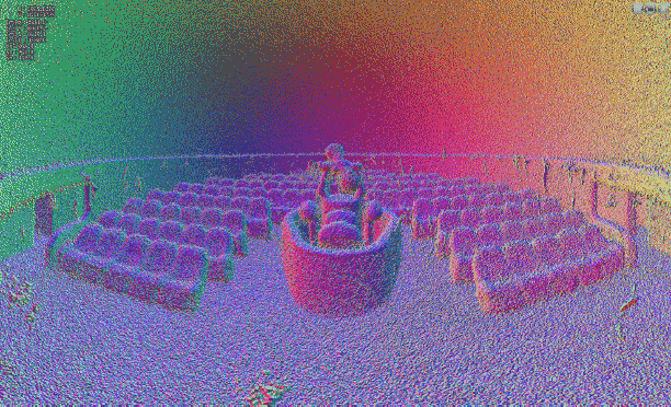
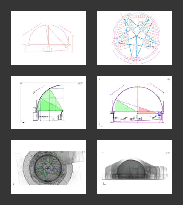
The precise placement of projectors in specially designed theatre rooms within planetariums is no easy task. Just measuring these rooms, which have sloping floors and domes, is a challenge. In addition, the measurement results and the design proposals derived from them must be communicated clearly and concisely to all project participants.
In the USA, the professionals from Seiler Instrument, more precisely Seiler’s Planetarium Division, are often called in for such jobs. Seiler employee Howard George used to use a combination of manual measurements and a total station for this task- a very time-consuming process. To speed up and simplify the process, laser scanning and PointCab’s point cloud software were therefore used for the first time.
The first step was to employ a handheld GeoSLAM ZEB Revo RT LiDAR scanner that creates 3D point clouds literally in minutes. Then the challenge was to efficiently extract the geometry and features to create BIM models of the spaces and better communicate the design intent to project stakeholders. To achieve this, Howard was provided with a trial version of PointCab 3D Pro (now Origins Pro). This is an easy-to-use point cloud editing and sharing software that was recommended by the Design Solutions team at Seiler. Howard comments, “In non-orthogonal areas like planetariums, PointCab allows me to freely tilt, rotate and magnify data points and orient perspectives. ” Thanks to the PointCab and Revit support, as well as online resources, Howard was able to start modelling from the point cloud within a few days, even as a novice, thanks to PointCab`s 4Revit plugin. This allowed him to simulate the placement of the projectors as-is and quickly create vectorised CAD schematics of the space and installation details. He was thrilled: “PointCab’s software exports 2D images of 3D spaces, but screen sharing the software via Zoom or simply forwarding my results with PointCab Share allows me to walk anyone through my process and show them whatever they want to see.”
Verschiedene Evaluationen in Origins Pro
The powerful combination of LiDAR scanning technology and PointCab Origins Pro has had a profound impact on the schedule and customer experience for these complex projector installations. Howard says: “I’m given metric spherical coordinates from ZEISS to place projectors in relation to the dome. In PointCab, I export Cartesian imperial coordinates to place the projector stands on the floor. Then the PointCab software exports 2D images of 3D spaces to me. Sharing data via PointCab Share (freeware) or screen sharing via Zoom allows me to share each step of the process with everyone and show in detail what is of interest.” In just one week, essential but very time-consuming tasks were thus radically reduced and changed for the better for everyone involved in the project. Once tested, the Seiler Planetarium Division would like to continue to rely on the combination of laser scanning and the PointCab software in the future.
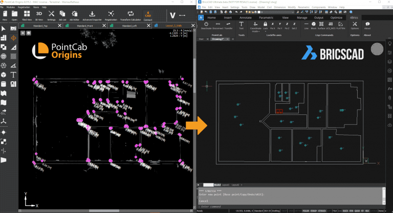
PointCab 4Brics - Why a BricsCAD point cloud plugin?
As you may know, we already developed point cloud plugins for Revit and Archicad. Now, we are happy to announce that we have also developed a plugin that will simplify the modeling of point clouds in BricsCAD. The decision to develop a BricsCAD plugin was an easy one. For months, more and more customers approached us and asked for us to develop a BricsCAD solution. Those who know our team know that we always try to implement customer requests as quickly as possible and try to respond to all requests. So it’s not surprising that we got to work right after the first requests came in.
How was the plugin developed?
We are developers and point cloud professionals. We are not BricsCAD experts and we openly admit to that. This is the reason why, when developing our BricsCAD plugin, we did what we always do in such cases – consult the expertise of our customers. Therefore we spent months studying the BricsCAD software and the workflow of our BricsCAD users. Special mention must be made here of Sebastian Zell, who has been massively involved in all stages of development, from conception to beta testing. The result is a plugin that perfectly matches the workflow of our BricsCAD customers and the architecture of the BricsCAD software.
What can the plugin do and how are point clouds modeled in BricsCAD with it?
Our 4Brics plugin helps you to transfer 3D information from Origins to BricsCAD in the correct position and in real-time. This way you don’t have to export the entire point cloud or individual orthophotos first and then import them into BricsCAD. As already mentioned, we have adapted our plugin to the architecture and structure of the BricsCAD software. That is why there is the function to fix axes. In principle, single or multiple axes can be fixed, depending on what is needed at the moment. For example, the x and y-axis can be fixed if heights are to be determined. Measurements are generally made with the 3D point tool in Origins. No matter whether lines, surfaces, or individual objects from your own templates are to be transferred – simply click on the desired element in Origins and it will be transferred to BricsCAD in the correct position. As usual, the 3D point tool can be used in the standard views, layouts & sections, or panoramic views. No matter which view you use, the information from the point cloud is always transferred correctly to BricsCAD. In addition to the transfer of 3D point cloud data, we have also implemented other functions that make your work in BricsCAD easier. For example, our multilines tool allows you to create several individual lines one after the other without interruption. Preparing your data for other CAD software is also done with just a few clicks. For example, you can transfer the data from your user coordinate system to the world coordinate system or flatten the heights. This way the data can also be read into CAD software like Revit or ArchiCAD.
If you want to learn more, take a look at our overview video or visit our online shop.
The Challenge: No Existing Floor Plans and Time-Sensitive Planning
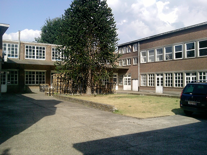
In this project, an old mustard factory was being converted into a residential building. The two-story, U-shaped structure contained former production rooms, storage areas and garages – but no current, reliable as-built plans were available for this complex task. 3D laser scanning provided the precise documentation needed for planning and design.
Converting an industrial building into residential space requires accurate knowledge of existing conditions. Without updated plans, planners and engineers risk costly errors during design and construction. In this case, the goal was to produce detailed floor plans and sections as CAD deliverables for the planning office – efficiently and within a short timeframe.
Capturing the Existing Building: Fast and Complete 3D Laser Scanning
The entire building was documented using 3D laser scanning within half a day. A total of 30 individual scans were carried out, capturing all relevant rooms, walls, openings and structural elements. This approach delivered a complete and detailed point cloud representing the actual condition of the building – an essential foundation when converting industrial structures into residential use.
Die Datenauswertung hat nur 2 Stunden geadauert, was mich wirklich überrascht hat!
Mitarbeiter Bouwsupport
Jun. 2013
From Point Cloud to CAD Plans: Efficient Evaluation with PointCab Origins
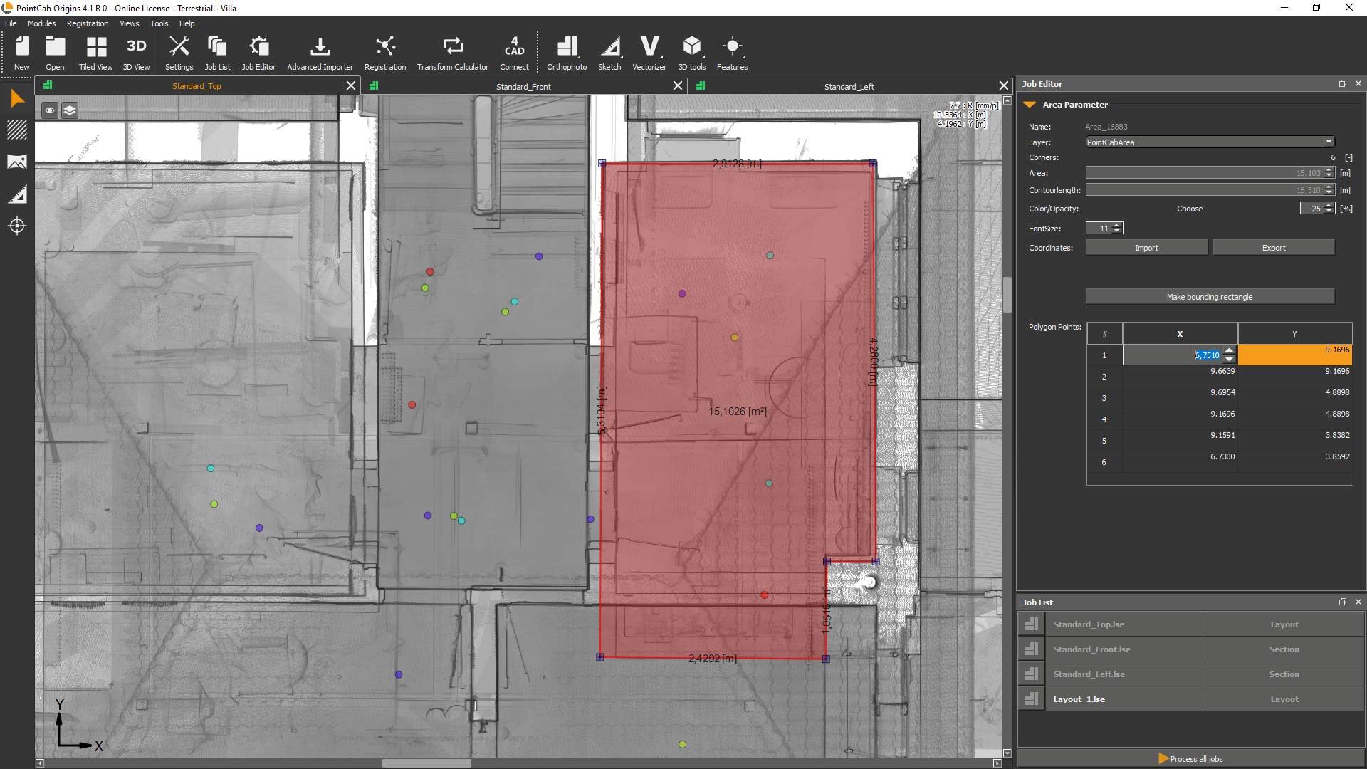
After data acquisition, the point cloud was evaluated using PointCab Origins. From the scan data, the required deliverables were derived efficiently:
floor plans,
cross sections,
and scaled, CAD-ready drawings.
The generated data could be imported directly into the customer’s CAD system and used for further planning steps without additional re-measurement or manual reconstruction.
Planning Benefits and Project Outcomes
The complete evaluation process – from raw scan data to exportable plans took approximately two hours. Based on the generated plans, the investment volume for the conversion could be assessed quickly and reliably. The resulting CAD data supported:
preliminary and design planning,
detailed execution planning,
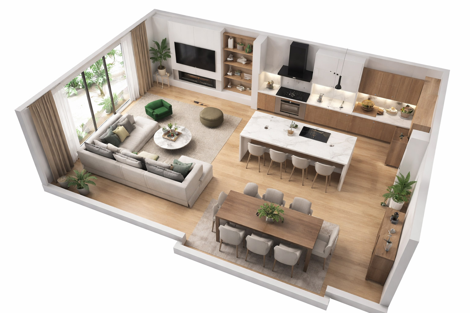
and visualizations for residential marketing and exposés.
This workflow provided a solid digital foundation for all subsequent project phases.
Want to keep up with the latest pointCab news?
Then follow us on Social Media or subcribe to our newsletter!
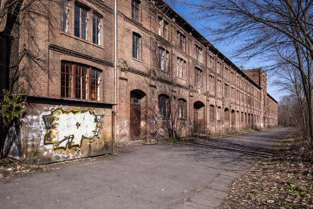
Requirements: Facade Documentation of Listed Building
In Magdeburg, a historic industrial building subject to preservation orders was undergoing conversion into residential loft apartments. To comply with heritage requirements and support renovation planning, highly accurate, true-to-scale documentation of the building’s facades was essential. Traditional measurement approaches were not feasible due to the narrow working space and the structure’s height, so a 3D laser scanning survey was commissioned. The 3D laser scanning survey, as well as the processing and modeling of the point cloud data was carried out by Laserscanning Europe.
Challenges of Capturing a Listed Facade
The building’s complex geometry presented multiple challenges:
The facades reach up to 17 m in height, making direct manual measurement risky and limited by space.
The east facade features multiple offsets and sloping sections, requiring detailed mapping to capture elements such as window surrounds and wall protrusions.
As a listed structure, all renovations must align with heritage preservation requirements, which demand accurate documentation of existing conditions before design can proceed.
These conditions made non-contact 3D laser scanning the only practical method to achieve comprehensive and precise data.
Survey Execution: 25 Scan Positions and Efficient Data Capture
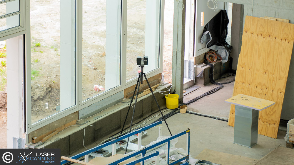
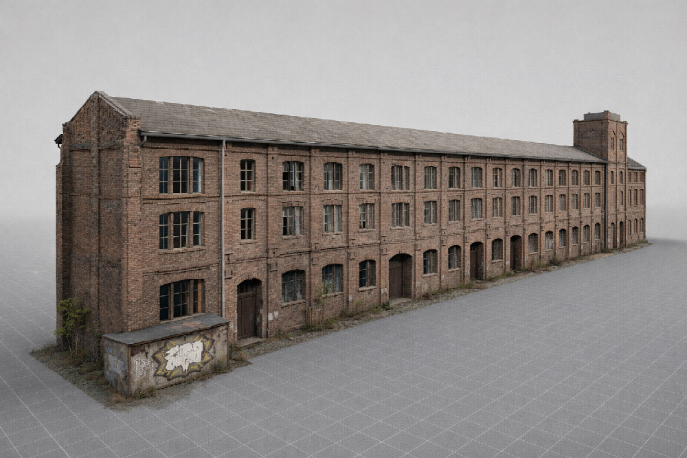
The team performed a total of 25 laser scanner setups across the three principal facades, covering a facade area of 1,720 m². Only one surveyor was needed on site, and the total scanning time was approximately 5 hours.
The result was a dense and complete point cloud representing all facade details – including irregularities and features that are critical for both preservation and renovation planning.
The rapid creation of scaled orthophotos allowed for quick analysis in Geograf.
Eric Bergholz
CEO, Laserscanning Europe GmbH
Dez. 2018
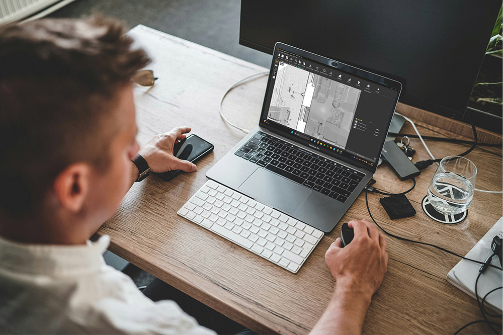
From Point Cloud to Digital Plans Using PointCab Origins and Geograf
Once the laser scanning was completed, the raw point cloud data was processed with PointCab Origins:
True-to-scale orthophotos were generated automatically.
The orthophotos and extracted measurements were imported into the CAD system Geograf within one hour.
Detailed 2D plans, including facade drawings and crack documentation, were created at a 1:50 scale.
This workflow enabled architects and engineers to immediately begin modeling and detailed planning for renovation and conversion. The CAD deliverables supported both the artistic design and the technical compliance needed for a listed building.
Why Detailed Facade Documentation Matters for Preservation Projects
For any structure under heritage protection, understanding the existing condition – especially at high resolution – is vital:
Preservation orders require that original characteristics be respected in renovation.
Irregularities (cracks, offsets, sloping segments) must be precisely recorded before any intervention.
A digital record supports historical documentation and prevents speculative or inaccurate reconstruction.
By using 3D laser scanning and rapid orthophoto generation, the project team not only met the strict accuracy requirements but also sped up the planning process, saving time and reducing risk during subsequent project phases.
Want to keep up with the latest pointCab news?
Then follow us on Social Media or subcribe to our newsletter!
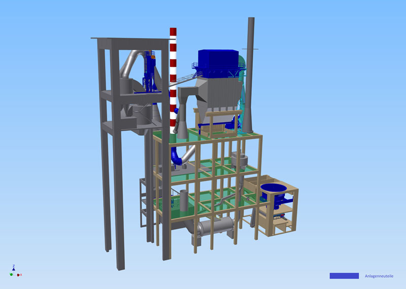
From Physical Reality to Actionable Insights: Capturing the Existing State
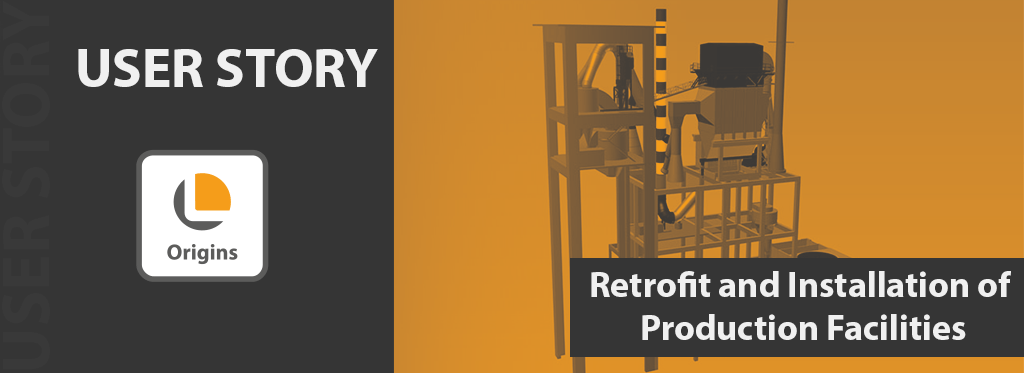
In a major project by Intercem Engineering GmbH, a leading supplier of turnkey solutions for cement plants, 3D laser scanning technology was deployed to support the conversion and upgrade of existing production infrastructure. The project involved the retrofit of an existing filter system on a concrete building and the installation of a new cyclone with a filter system within the concrete framework of a heat exchanger.
Because precise as-built documentation was essential to plan prefabrication and avoid costly rework, the team chose to use 3D laser scanning. The method proved to be fast, efficient and safe — even in hard-to-access areas, providing a robust digital foundation for retrofit planning.
The Challenge: Adapting Production Infrastructure Within an Existing Concrete Shell
Retrofitting a filter system and installing a new cyclone in an existing concrete structure poses multiple challenges:
Exact compatibility required between new equipment and existing geometry – tolerances had to be respected to avoid alignment issues.
Some areas of the building were difficult to access, making manual measurement hazardous or unreliable.
Any misfit would lead to costly rework, shutdowns or delays in installation.
In this context, traditional measurement methods bear high risk. 3D laser scanning offered a precise, comprehensive and reliable alternative.
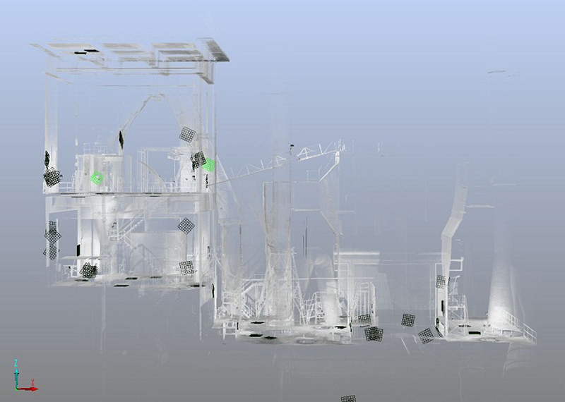
How the Survey Was Performed: FARO Laser Scanner + Point Cloud Registration in FARO Scene
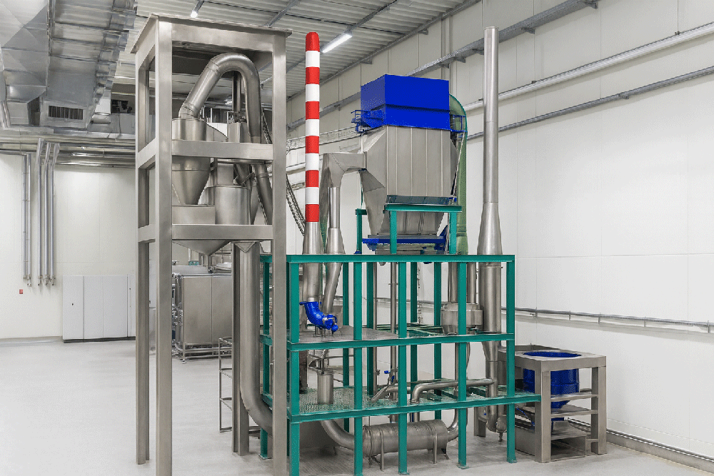
For this project, a laser scanner by FARO was used. For the retrofit of the filter system, 7 scans were made; for the heat exchanger area, 10 additional scans covered the relevant geometry.
After data capture, all scans were registered and merged in FARO Scene, producing a unified point cloud of the building’s interior geometry. This ensured high accuracy and comprehensive coverage – even in difficult-to-reach zones.
We were able to use FARO laser scanner data as floor plans in Inventor thanks to PointCab Origins.
Intercem Engineering GmbH
Jun. 2013
Processing the Point Cloud: From Scan to CAD-ready Data
Once the point cloud data was ready, PointCab Origins was used to define floor plans and sections from the scan data easily and quickly. Then, the resulting CAD-ready data was imported into the mechanical CAD software Autodesk Inventor, where final modeling took place.
This Scan-to-CAD workflow provided:
Accurate floor plans and sectional data based on real-world conditions
A reliable basis for the prefabrication of new components (filter system, cyclone)
Minimized risk of misalignment, rework or installation errors
Why 3D Scanning Is Essential for Industrial Retrofit Projects
This case highlights several key strengths of 3D laser scanning in industrial environments – especially when modifying existing facilities:
Precision: Point clouds capture true as-built geometry, including irregularities or deformations in old concrete structures.
Coverage: Even hard-to-access areas are recorded — no need for manual measuring in confined or hazardous zones.
Planning reliability: CAD/CAD-BIM models generated from scan data allow for prefabrication and exact fit of new installations.
Time and cost savings: Avoiding on-site rework, installation delays or retrofit errors reduces overall project risk and expense.
In short: for industrial retrofit and conversion projects, 3D laser scanning is often not just useful — it is indispensable.
Want to keep up with the latest pointCab news?
Then follow us on Social Media or subcribe to our newsletter!