USER STORY
Surveying Dunelm House – home of the Durham Univerity Students' Union (DSU)

Dunelm House: Why a Precise 3D Survey Was Needed
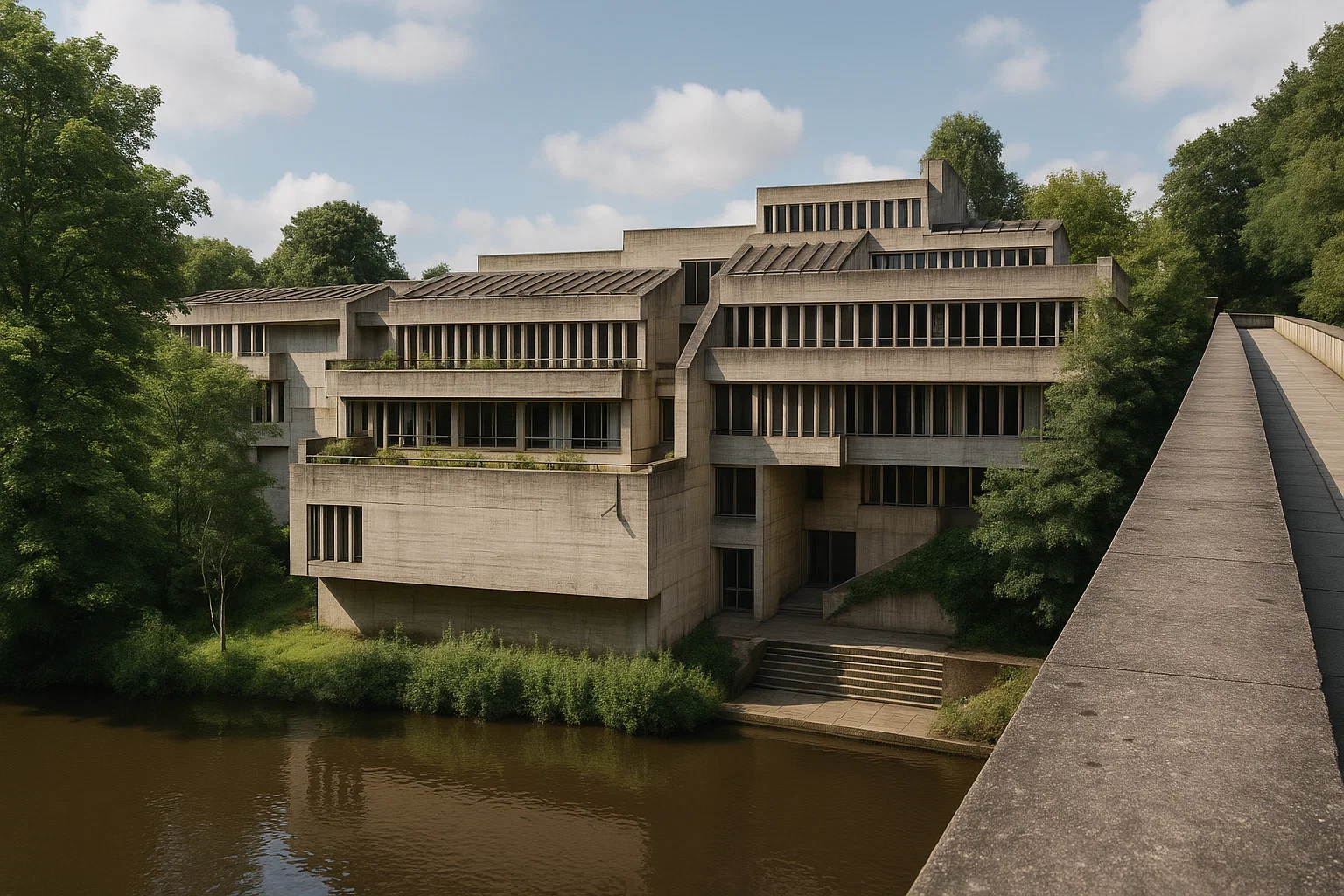
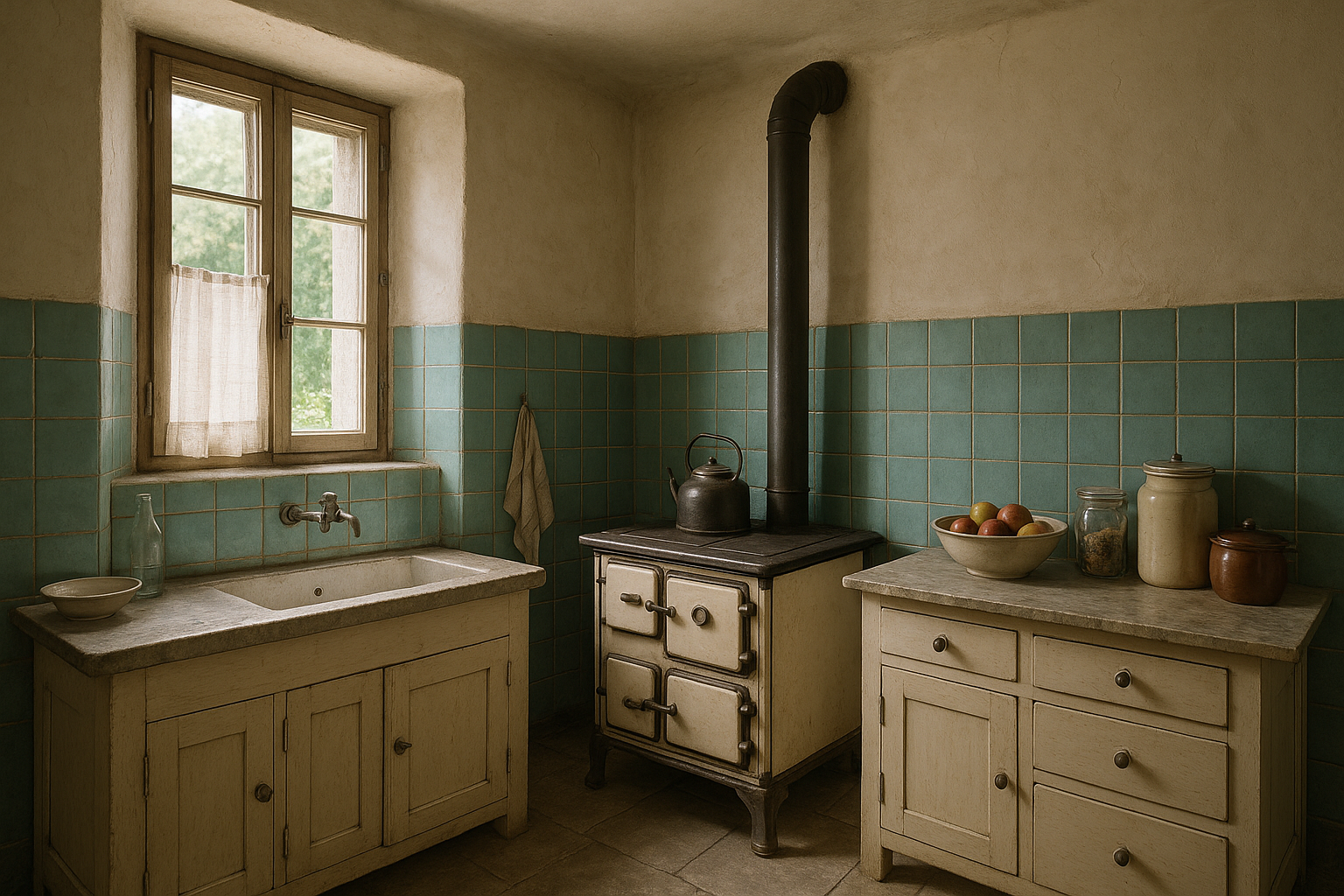
Dunelm House (1966) is Durham University’s well-known students’ union building. Designed in the post-war modernist style, it sits directly on the steep banks of the River Wear. Furthermore, it is connected to the equally iconic Kingsgate Bridge.
The structure is characterized by exposed concrete and terraced floor levels. A multi-angled, irregular roofscape follows the natural slope of the riverbank. This bold design makes Dunelm House architecturally significant – and challenging to measure.
When leaks appeared across several roof areas, a detailed digital survey was needed. The aim was to document the current condition and guide the renovation.
The Challenge: Complex Roof and Difficult Site Conditions
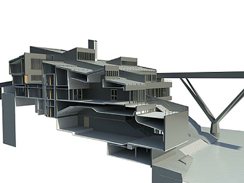
The student building’s roof consists of intersecting levels, changing slopes, and unconventional angles. Combined with its sloping riverside location, this makes traditional measurement methods unreliable and slow.
To capture the structure accurately and efficiently, the project required a modern surveying approach capable of documenting every plane and surface with precision.
How the Survey Was Completed: Laser Scanning + GPS
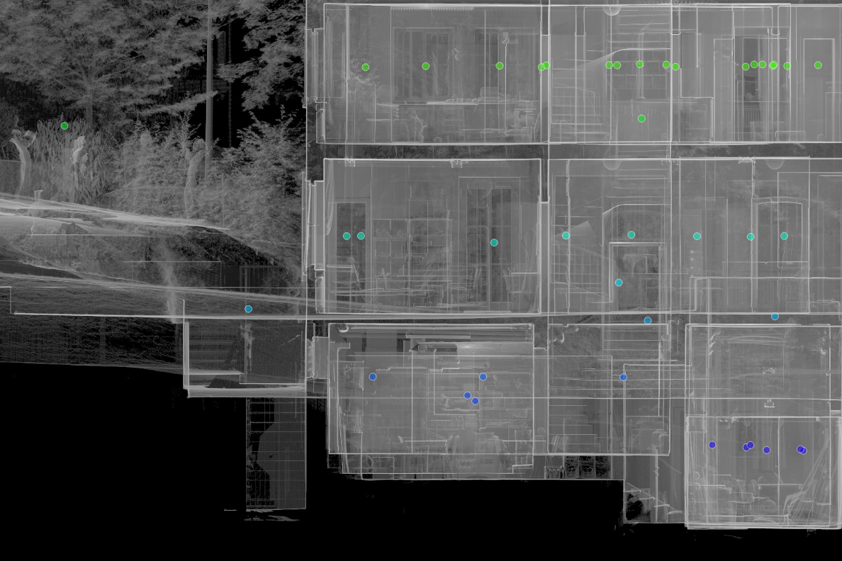
The survey was carried out by Bury Associates Ltd using two FARO Focus3D laser scanners. To record the terrain and ensure accurate referencing across the entire site, the team also used total stations and GPS equipment.
This hybrid surveying method made it possible to capture:
- the full exterior geometry of Dunelm House,
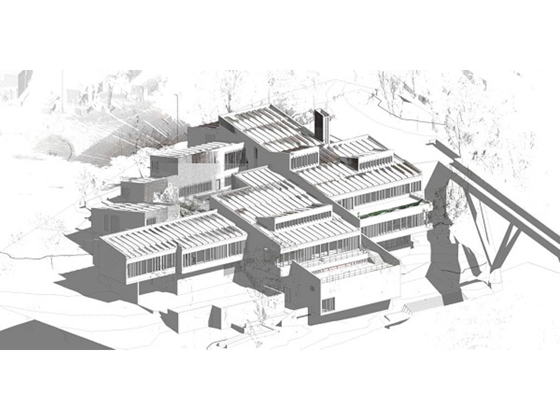
- its complex multi-level roof structures,
- and high-precision topographic context along the River Wear.
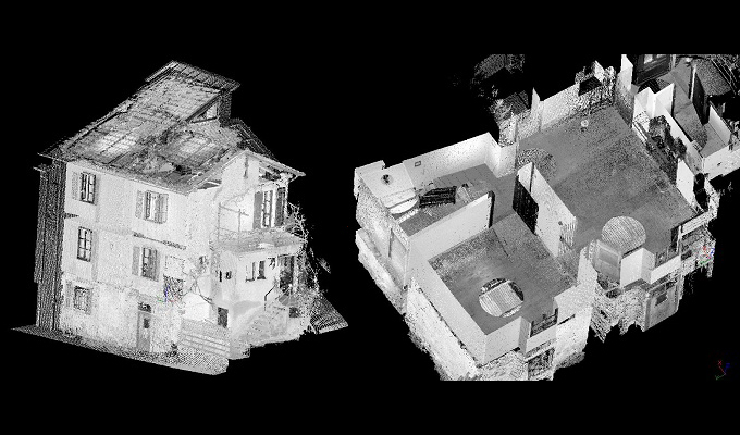
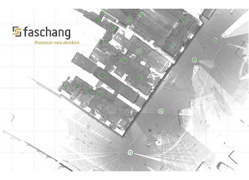
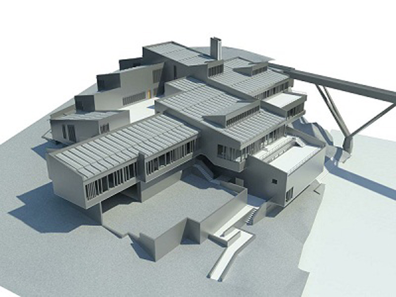
The result was a detailed point cloud covering the entire building and its surroundings.
From Point Cloud to 3D Model: Deliverables in Four Days
After the scanning process, the data was processed using PointCab Origins, which enabled the team to deliver complete documentation in just four days.
The deliverables included:
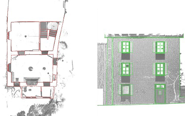
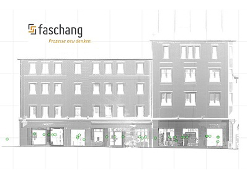
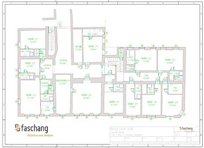
- orthophotos,
- 2D floor plans,
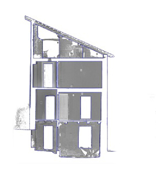
- sections and elevations,
- and a full 3D Revit model created from the processed Origins data.
By exporting PointCab’s results into Autodesk Revit, the project team gained a BIM-ready model with the accuracy needed to analyse the leaking roof and plan the renovation.
How the Digital Survey Supports the Renovation Process
The Dunelm House project shows how 3D laser scanning, precise site measurement, and point cloud processing can deliver fast, reliable results — even for buildings with complex shapes and challenging site conditions.
With the combination of FARO scanners, survey instruments, and PointCab Origins for evaluation, Bury Associates delivered a complete set of renovation-ready outputs, including a detailed Revit model.
This provided architects and engineers with a solid digital foundation for repairing and preserving one of Durham’s most distinctive architectural landmarks.
Want to keep up with the latest pointCab news?
Then follow us on Social Media or subcribe to our newsletter!