
USER STORY
Innovative Road Surveying with 3D Laser Scanning, Photogrammetry, and 3D Printing

Contents
What it’s about?
Project start: planning and preparation
Two methods, one goal: laser scanning meets drone
Data fusion and processing: from raw data chaos to point cloud
Analysis and profile creation with pointcab origins
From cross-section to physical model: further dtm processing
Additional evaluation: virtual tour and plan drawings
Conclusion: clear planning, efficient workflow
Project participants
WHAT IT'S ABOUT?
For his thesis in Civil Engineering (Infrastructure) at DHBW Mosbach, Maximus König relied on a modern, combined workflow for as-built documentation.
The project goal was clearly defined: to create an accurate, digitally viable documentation of an existing retaining wall along the L172 through-road in the Hammereisenbach district. In addition to digital plans, a physical 3D model was to be produced as a demonstration object.
The approach: combining modern technologies such as terrestrial laser scanning, drone photogrammetry, point cloud processing, and 3D printing.
PROJECT START: PLANNING AND PREPARATION
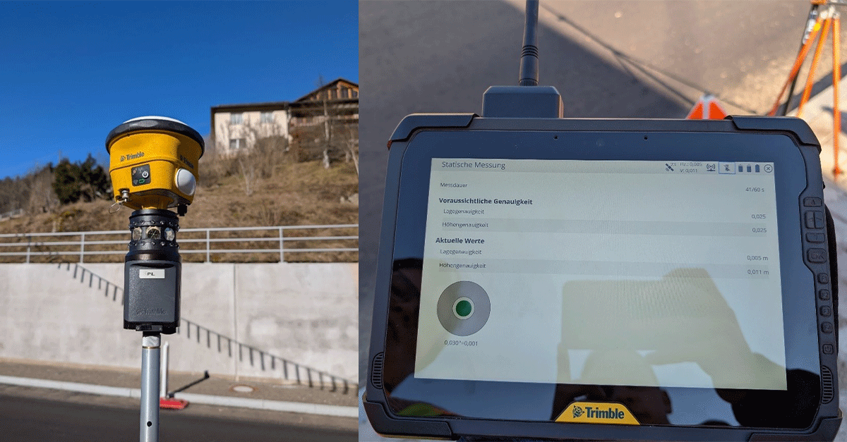
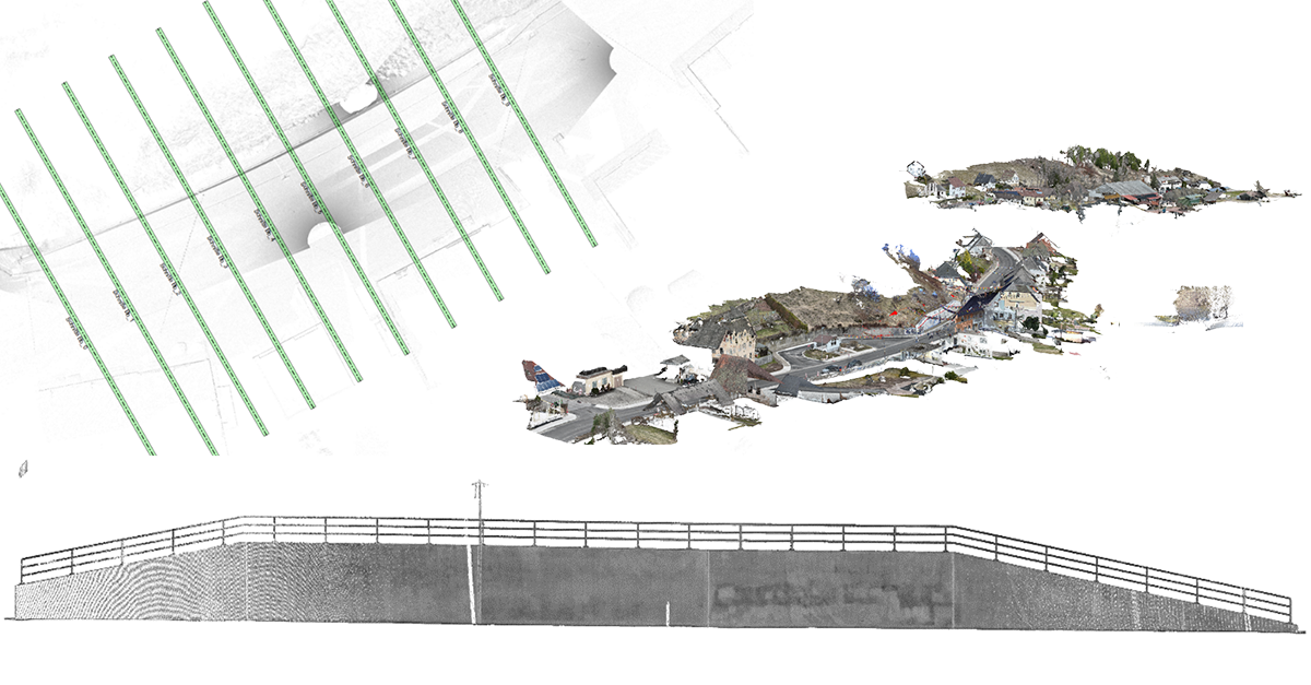
Before starting with the data collection, Maximus established a control point network. This served both for the positioning of the terrestrial laser scanner and the georeferenced evaluation of the drone imagery. With this setup, the foundation was laid to merge both measurement technologies and align their data with precise coordinates.
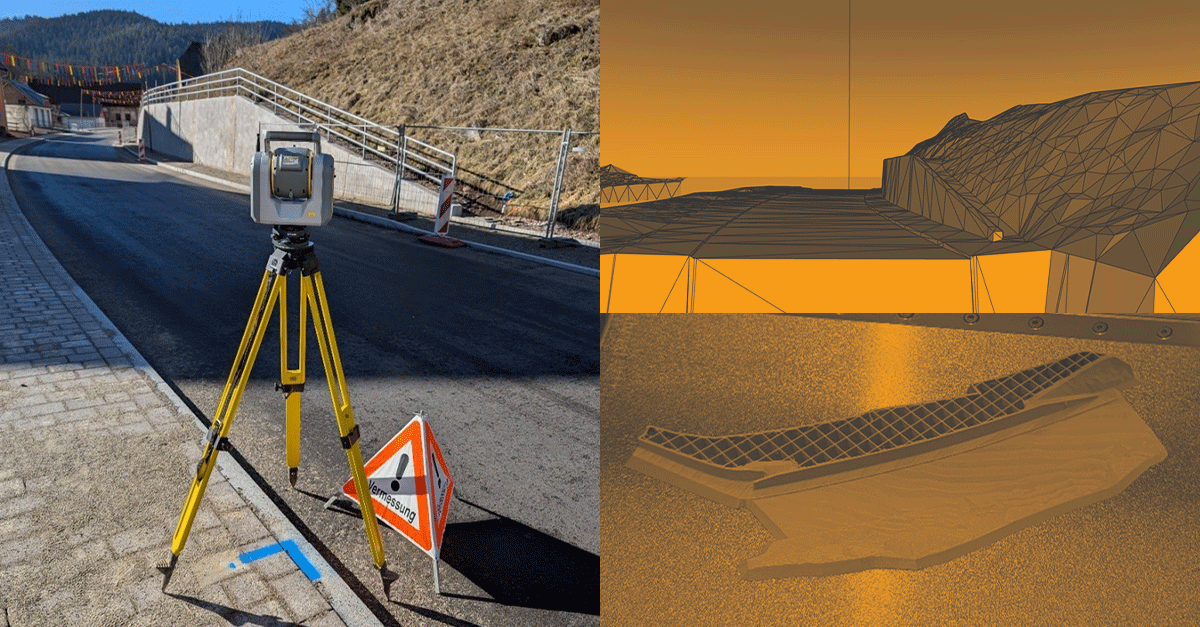
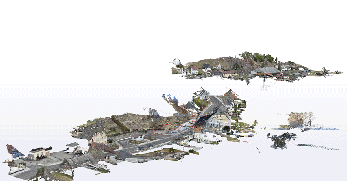
TWO METHODS, ONE GOAL: LASER SCANNING MEETS DRONE
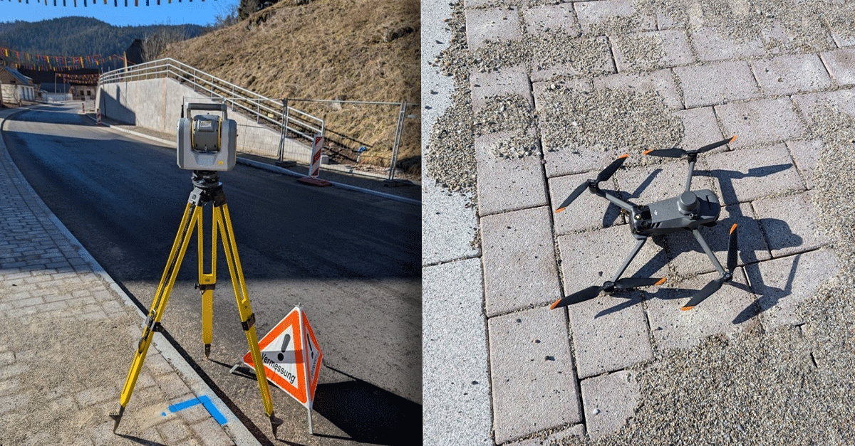
The survey combined terrestrial laser scanning with photogrammetric drone flights:
The Trimble SX12, a highly precise terrestrial laser scanner, provided detailed point cloud data of the retaining wall area and the surrounding roadway.
In parallel, a drone survey was conducted with the DJI Mavic 3 Enterprise. Through photogrammetric processing, another point cloud was generated.
The drone flight took only about 20 minutes, while the terrestrial scanning – requiring multiple setups – lasted around three hours.
DATA FUSION AND PROCESSING: FROM RAW DATA CHAOS TO POINT CLOUD
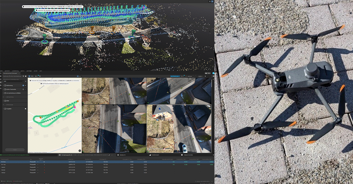
After completing the fieldwork, the captured data was processed in PIX4Dmapper, which took about one hour. This included:
Georeferencing the drone images using the previously placed control points,
Generating a point cloud from the orthophotos, and
Merging the drone and laser scan data into one precise, unified point cloud.
This combined point cloud then served as the basis for all further steps.
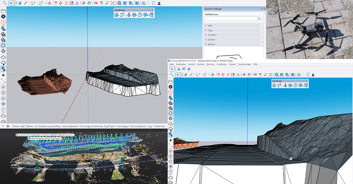
ANALYSIS AND PROFILE CREATION WITH POINTCAB ORIGINS
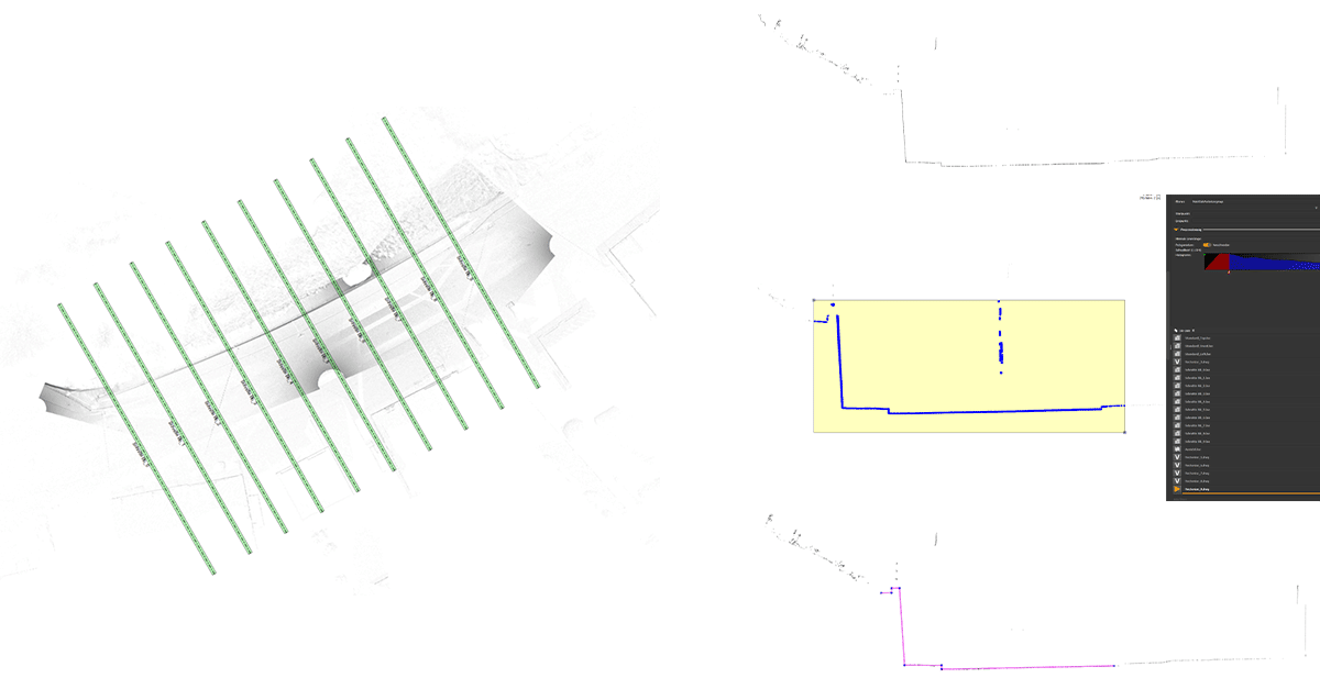
The unified point cloud was imported into PointCab Origins, where Maximus first created an overhead view and then derived cross-sections and profiles.
The integrated vectorization tools were especially useful: they allowed for the fast creation of linework, which could be exported directly as DXF files. These DXFs were then used in other CAD programs – for plan generation or for building a digital terrain model (DTM).
Processing in PointCab Origins took about four hours in total. The efficiency and precision in creating profiles proved particularly valuable.
FROM CROSS-SECTION TO PHYSICAL MODEL: FURTHER DTM PROCESSING
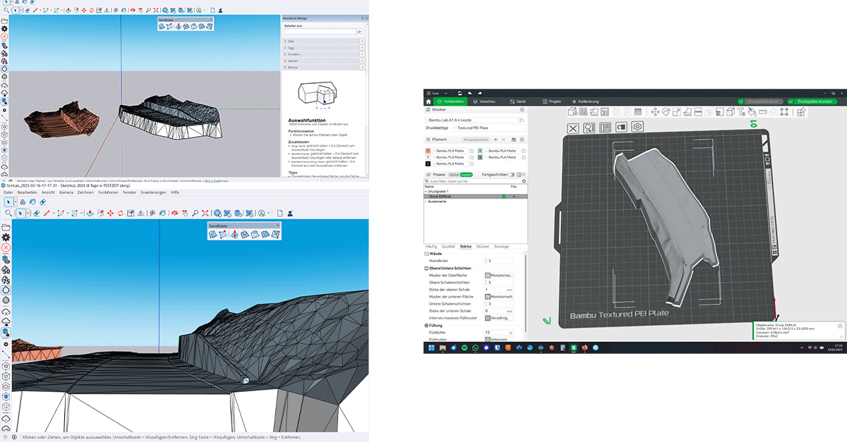
Next, the exported DXF profiles were imported into RIB Civil, where Maximus created a digital terrain model (DTM) of the surveyed area. This model was then transferred into SketchUp and merged into a solid body with a closed surface.
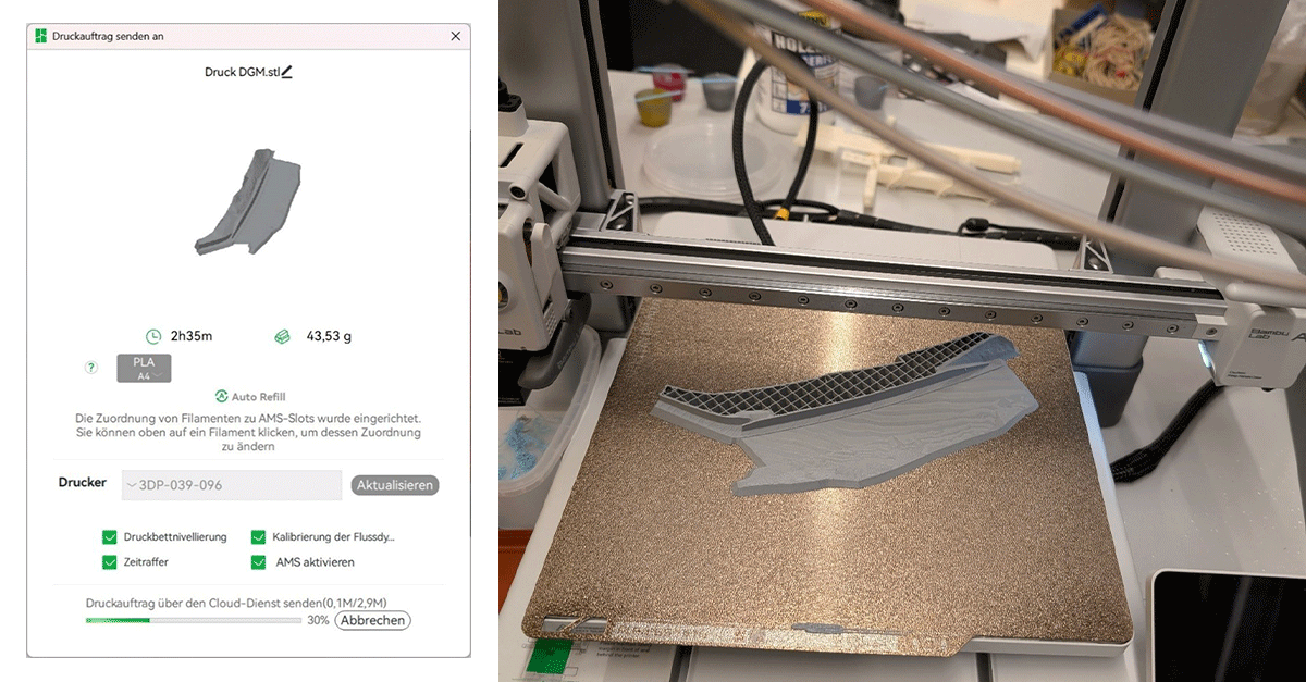
The final preparation of the 3D model for printing was done in Bambu Studio, where it was converted into the required STL format. The 3D print itself marked the grand finale: a tangible model of the roadway section – ideal for presentations and discussions with project stakeholders.
ADDITIONAL EVALUATION: VIRTUAL TOUR AND PLAN DRAWINGS
Using Trimble Business Center, Maximus created a virtual walkthrough of the point cloud, which took about one hour. This type of visualization offers an intuitive look at the structure and can be used for public participation or planning workshops.
For those looking for a simpler, location-independent way to view point clouds, PointCab Nebula provides an alternative. While it cannot generate flythroughs, the cloud platform makes it easy to view and share large point cloud datasets directly in a web browser – perfect for project teams or clients.
Additionally, the cross-sections generated in PointCab were imported into AutoCAD to create traditional plan drawings for the project documentation. This step took about six hours but delivered professional results fully comparable to standard CAD plans.
CONCLUSION: CLEAR PLANNING, EFFICIENT WORKFLOW
With his project, Maximus König demonstrated impressively how modern surveying methods and software tools can be combined effectively, from data acquisition to analysis and visualization. The key to success lay in carefully planning the workflow and using specialized software for each step.
Maximus looks back and reflects:
“Creating a plan at the beginning and mapping out which software is needed for which task and goal saves an enormous amount of time.”
His project proves:
with a well-thought-out workflow and the right tools, even complex infrastructure projects can be digitally captured efficiently, precisely, and presented in a way that is both clear and engaging.
Project Participants
The project was carried out by Maximus König as part of his final thesis, “Innovative Road Surveying with 3D Laser Scanning.”
University: DHBW Mosbach
Degree Program: Civil Engineering (Infrastructure)
Want to keep up with the latest pointCab news?
Then follow us on Social Media or subcribe to our newsletter!