
Where does laser scanning come from? Who invented it?
How has laser scanning been used over the past decades up to today?
Our series “The origins of laser scanning” gets to the bottom of these questions and provides answers about this fascinating technology, which by now is hardly imaginable to live without in our everyday lives.
A laser, a flight to the Moon – and the start of a revolution in surveying technology
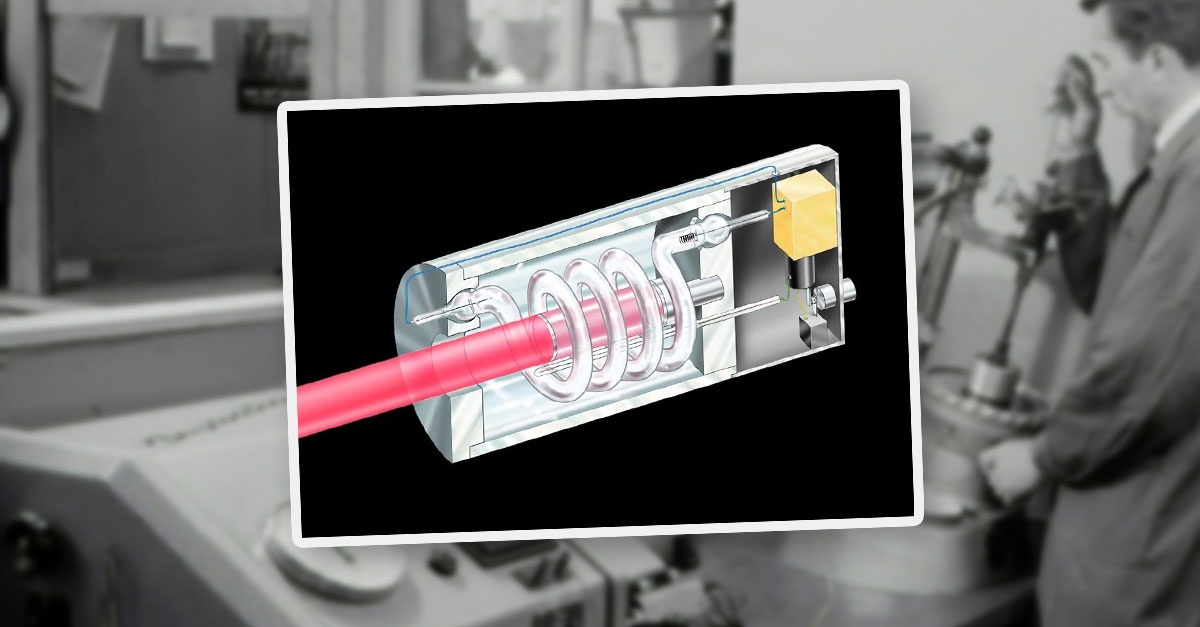
In 1960, US physicist Theodore Maiman at the Hughes Research Laboratories developed the first functional laser. It was based on a ruby crystal and marked the starting point for a new era of measurement and sensor technology.

Theodore Maiman invented the laser because he wanted to transfer the principle of the maser to light instead of microwaves. Despite initial rejection from his superiors, he continued the research on his own initiative under the threat of being fired. Practical applications were initially unclear – Maiman himself called the laser “a solution looking for a problem.”
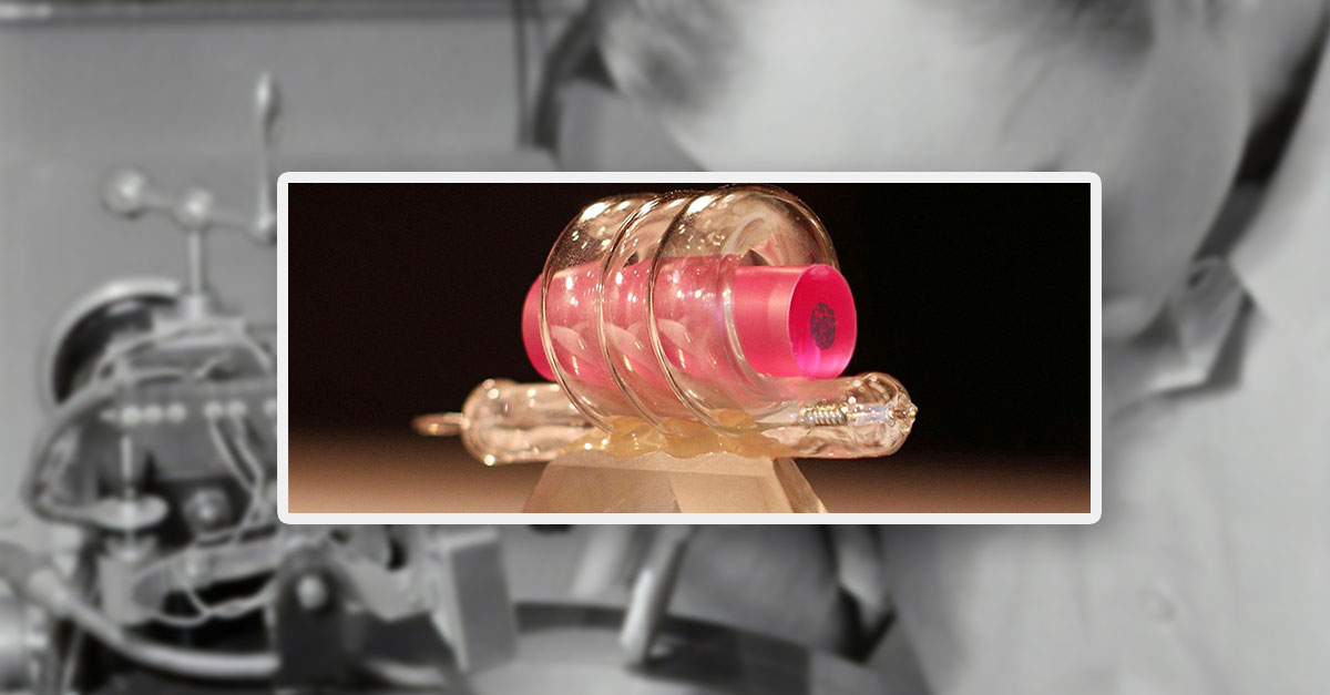
On May 16, 1960, Theodore Maiman and Charles Asawa built the first functional ruby laser. Despite the initial rejection, Maiman was given a limited budget and published his results in August 1960 in the journal Nature. The invention spread quickly, but his employer remained skeptical. In 1962, Maiman therefore founded the Korad Corporation; the US patent followed in 1967.
Fun Fact:
The “father of the laser” Theodore Maiman never received the Nobel Prize – but in the year 2000, his own invention was used to perform laser surgery on him in Munich.

Just one year after Maiman’s development of the laser, Hughes Aircraft Company built the first LiDAR prototype (Light Detection and Ranging).
The principle: Short laser pulses are emitted, hit a target, and reflect back. From the time the light takes for the round trip, the distance can be calculated.
What is LiDAR?
LiDAR stands for Light Detection and Ranging. A device emits laser pulses and measures the time until the light is reflected from the target. This makes it possible to determine distances and structures precisely – often with millimeter accuracy.
Military beginnings
As early as the 1950s, the US military experimented with optical measuring devices – an early precursor of today’s LiDAR systems. In the 1960s, LiDAR was initially used for military terrain mapping and reconnaissance.
Apollo 15 – LiDAR in space
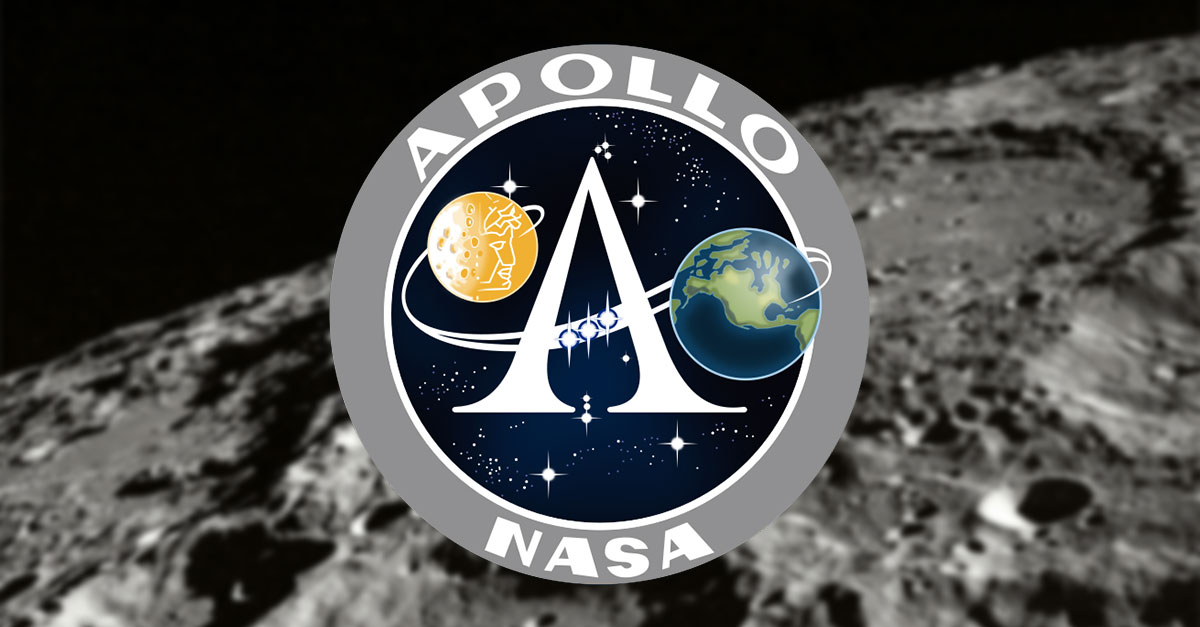
In 1971, LiDAR experienced its international breakthrough: NASA used the technology on the Apollo 15 mission to map the surface of the Moon. Using a flashlamp-pumped ruby laser, thousands of measurements of the lunar topography were carried out from orbit.
Slow development until the 1980s
Use in aerospace grew in the 1970s, for example for topographic mapping of landscapes, ice sheets, oceans, and the atmosphere. Only with the availability of commercial GPS systems and improved satellite communication in the 1980s did LiDAR become practical for more precise and efficient airborne measurements.
Did you know…?
… the Apollo 15 mission in 1971 used LiDAR to measure the Moon’s surface from orbit? This made LiDAR the first laser-based measuring method in space.
Here’s what’s coming next:
In the next part of our series, we will look at the transition from research to the practical use of LiDAR technologies in the decades up to the late 1990s.
Want to keep up with the latest pointCab news?
Then follow us on Social Media or subcribe to our newsletter!