
USER STORY
Facade Elevation of a Listed Industrial Building: Precise 3D Survey for Renovation Planning

Requirements: Facade Documentation of Listed Building
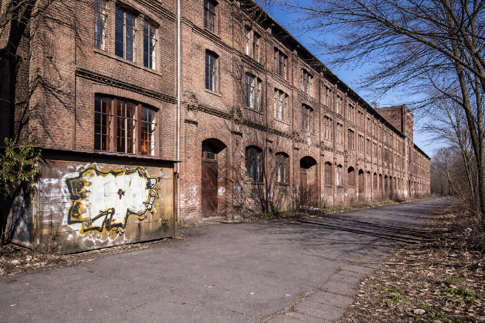
In Magdeburg, a historic industrial building subject to preservation orders was undergoing conversion into residential loft apartments. To comply with heritage requirements and support renovation planning, highly accurate, true-to-scale documentation of the building’s facades was essential. Traditional measurement approaches were not feasible due to the narrow working space and the structure’s height, so a 3D laser scanning survey was commissioned. The 3D laser scanning survey, as well as the processing and modeling of the point cloud data was carried out by Laserscanning Europe.
Challenges of Capturing a Listed Facade

The building’s complex geometry presented multiple challenges:
- The facades reach up to 17 m in height, making direct manual measurement risky and limited by space.
- The east facade features multiple offsets and sloping sections, requiring detailed mapping to capture elements such as window surrounds and wall protrusions.
- As a listed structure, all renovations must align with heritage preservation requirements, which demand accurate documentation of existing conditions before design can proceed.
These conditions made non-contact 3D laser scanning the only practical method to achieve comprehensive and precise data.
Survey Execution: 25 Scan Positions and Efficient Data Capture

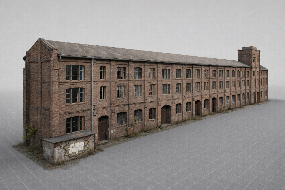
The team performed a total of 25 laser scanner setups across the three principal facades, covering a facade area of 1,720 m². Only one surveyor was needed on site, and the total scanning time was approximately 5 hours.
The result was a dense and complete point cloud representing all facade details – including irregularities and features that are critical for both preservation and renovation planning.
From Point Cloud to Digital Plans Using PointCab Origins and Geograf

Once the laser scanning was completed, the raw point cloud data was processed with PointCab Origins:
- True-to-scale orthophotos were generated automatically.
- The orthophotos and extracted measurements were imported into the CAD system Geograf within one hour.
- Detailed 2D plans, including facade drawings and crack documentation, were created at a 1:50 scale.
This workflow enabled architects and engineers to immediately begin modeling and detailed planning for renovation and conversion. The CAD deliverables supported both the artistic design and the technical compliance needed for a listed building.
Why Detailed Facade Documentation Matters for Preservation Projects
For any structure under heritage protection, understanding the existing condition – especially at high resolution – is vital:
- Preservation orders require that original characteristics be respected in renovation.
- Irregularities (cracks, offsets, sloping segments) must be precisely recorded before any intervention.
- A digital record supports historical documentation and prevents speculative or inaccurate reconstruction.
By using 3D laser scanning and rapid orthophoto generation, the project team not only met the strict accuracy requirements but also sped up the planning process, saving time and reducing risk during subsequent project phases.
Want to keep up with the latest pointCab news?
Then follow us on Social Media or subcribe to our newsletter!